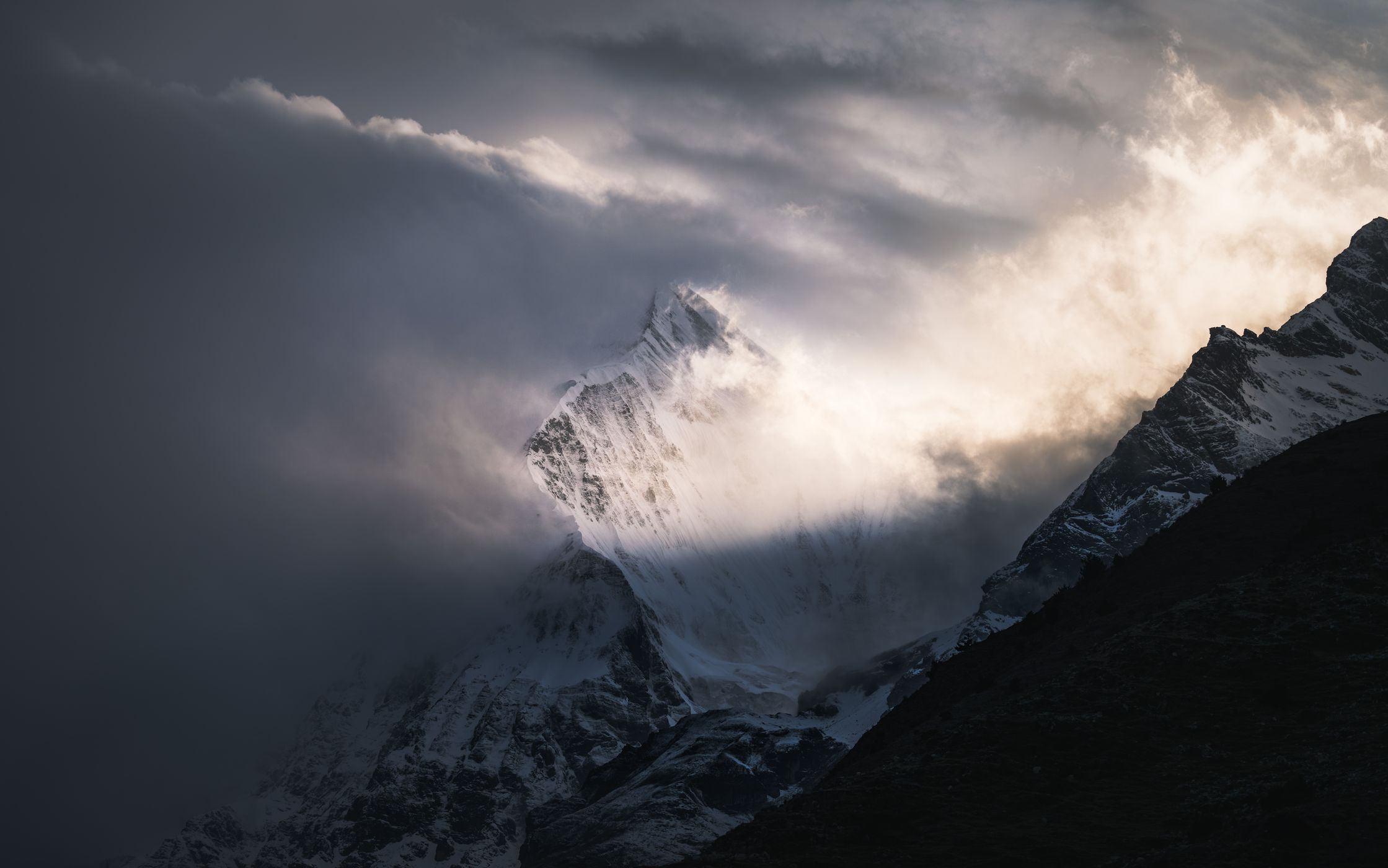

Bhutan Tserim Kang View, Chebisa
The mighty Tserim Kang is one of the highest unclimbed mountains in the world with a summit of 6.532m. Due to its exposed ice capped location, the weather creates insane sceneries around it.
Photography Tips
Use your zoom lenses to isolate the mountain from the rest of its surroundings. Expose for the highlights.
Travel Information
In order to get to this remote and superb place, you would need to hike for several days through the Himalayan mountains. To reach here, a multi-day hike is mandatory. Starting from Paro into the route, the minimum amount of days to get here is 4-5 days with an average elevation gain of around 800-1.000m per day as well as 12-18km per day.
Spot Type
Outdoor
Crowd Factor
Nearly no other people
Best Timing
Sunrise in spring
Sunrise & Sunset
05:29 - 18:32
| current local time: 11:50
Photo Themes
dramatic sky
Himalaya
Himalayas
moody
Mountain Summit
Mountains
Locations
Himalayas
Himalaya
Tserim Kang


Spot Comments (0)