Tsenda Kang, Upper View from Laya, Bhutan
Sebastian Lehrke
Sebastian Lehrke www.sebastianlehrkepho…
licensable
This photo is copyrighted by the author.
Thank you for respecting the rights and efforts of our photographers. Please contact the author for further information.

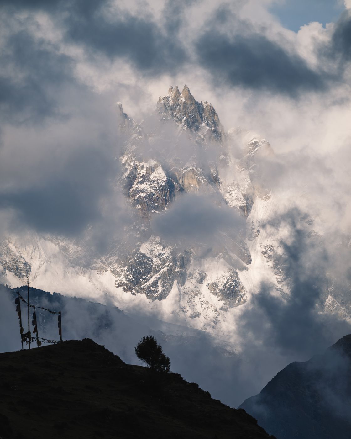
Bhutan Tsenda Kang, Upper View from Laya

  • Please log in or sign up for free to see the GPS coordinates & weather for this photo spot
The Tsenda Kang is a majestic 6.481m high mountain. The weather keeps always being dramatic around this peak.

Photography Tips

Take your zoom lens with you and try to create an interesting image by taking some trees or prayer flags in the foreground.

Travel Information

To get to the remote village of Laya, you would need to take a hike. The shortest option is to get to the road point close to the military point between Gasa and Laya. From there, you need to take a around 400-500m elevation climb and around 10-12km (in dependency on the trail conditions). Take care of proper acclimatization. Laya lies at 3.900m and higher.
Spot Type Outdoor
Crowd Factor Nearly no other people
Best Timing Sunset during spring
Sunrise & Sunset 05:47 - 18:02 | current local time: 07:12
Photo Themes dramatic sky Himalaya Himalayas mountain view Mountains Sunset
Locations Laya Tsenda Kang

Get the exact geo-position for this spot

Log in to see the GPS coordinates, sun directions, and the map for this photo spot. Or simply bookmark it along with other spots to plan your next trip.

Spot Comments (0)

Please log in or sign up for free to leave a comment or ask a question.

Ratings (1) starstarstarstarstar

starstarstarstarstar
1
starstarstarstarstar
0
starstarstarstarstar
0
starstarstarstarstar
0
starstarstarstarstar
0

Popular photo spots in this region

Thank you Sebastian Lehrke for creating this photo spot in Bhutan.
Imprint & Contact © Locationscout 2024 Privacy / Terms