")
Canada Cape Clear
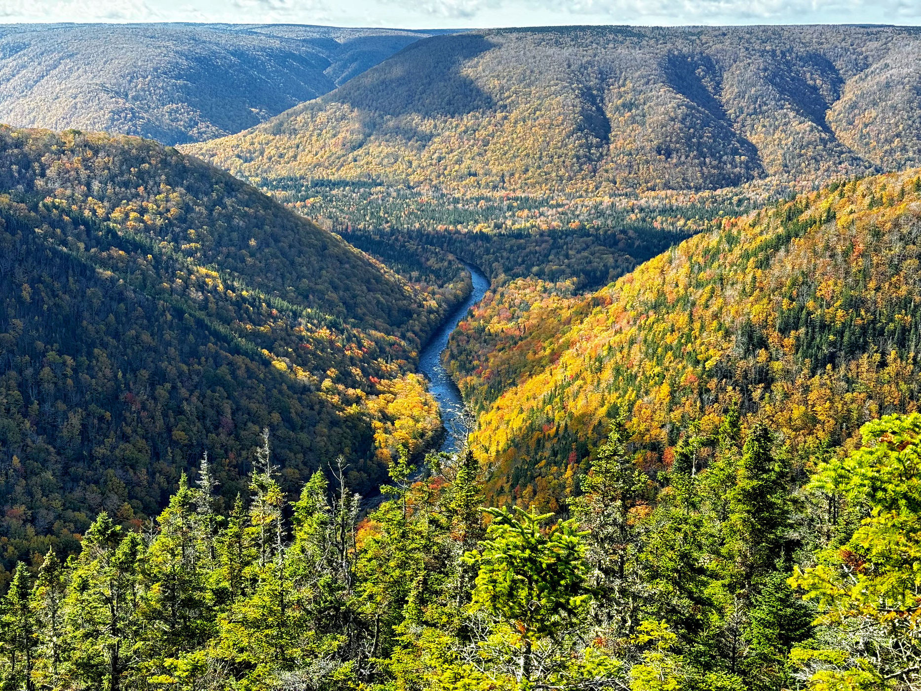
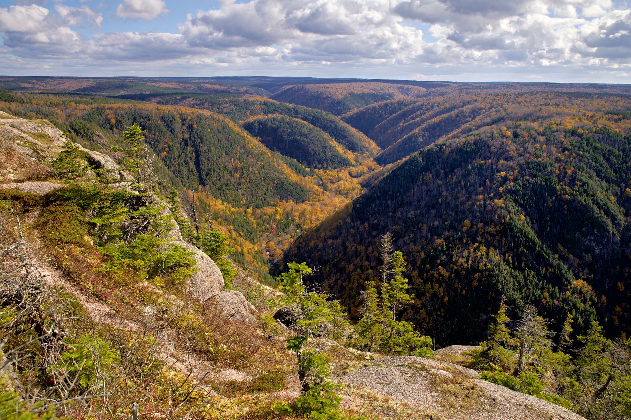
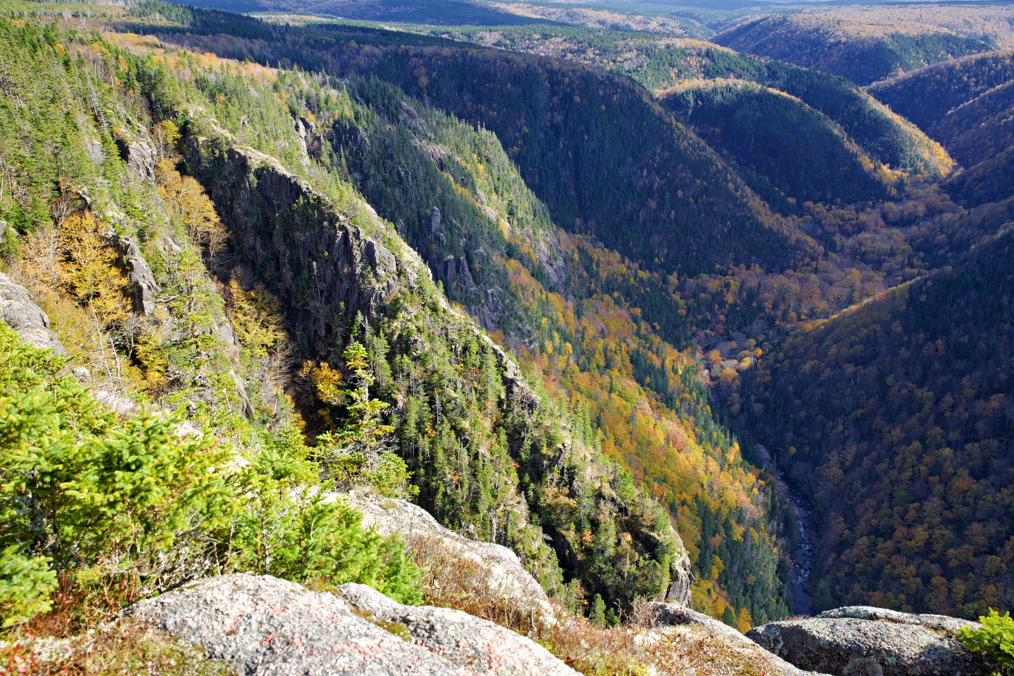
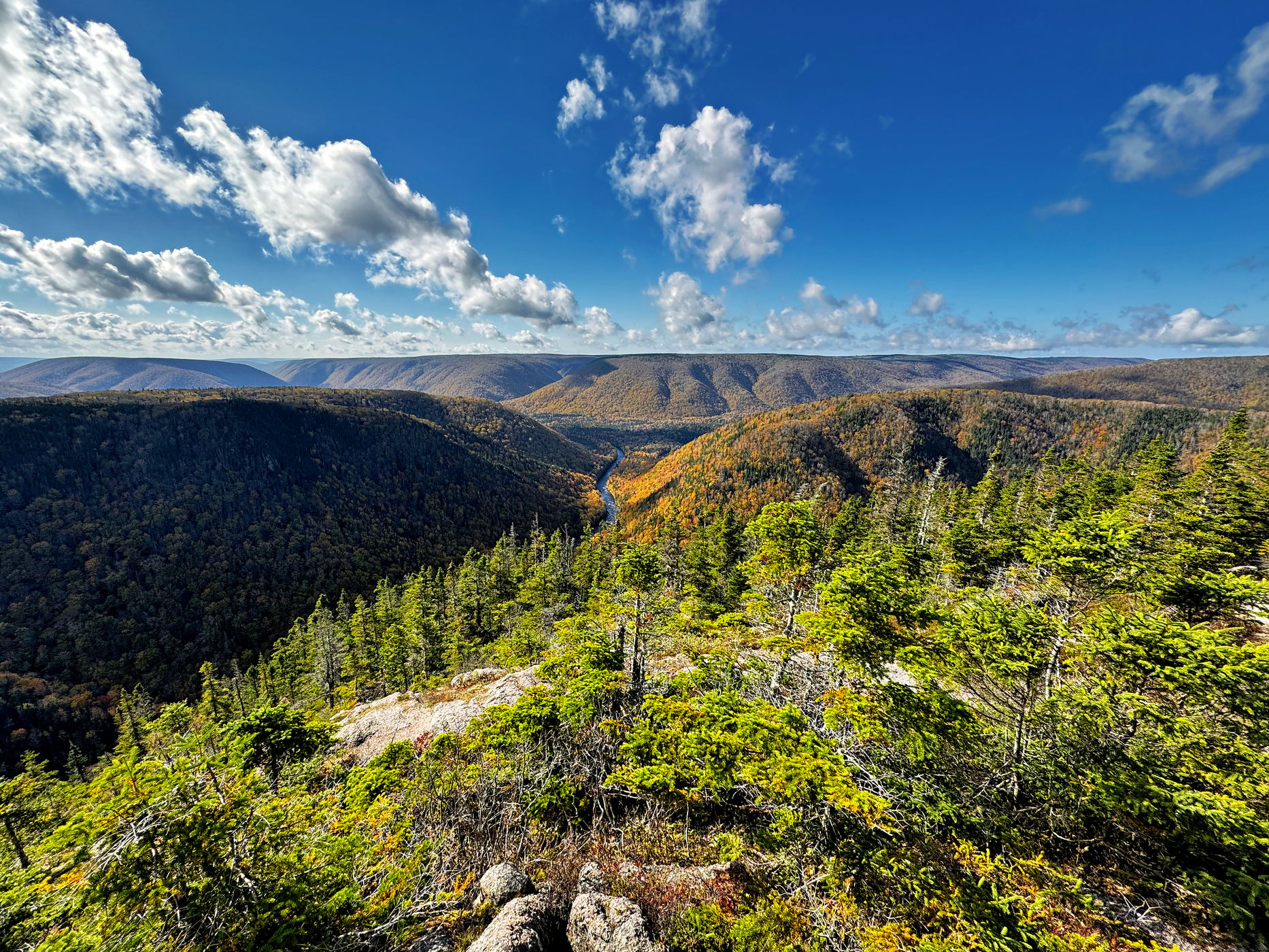
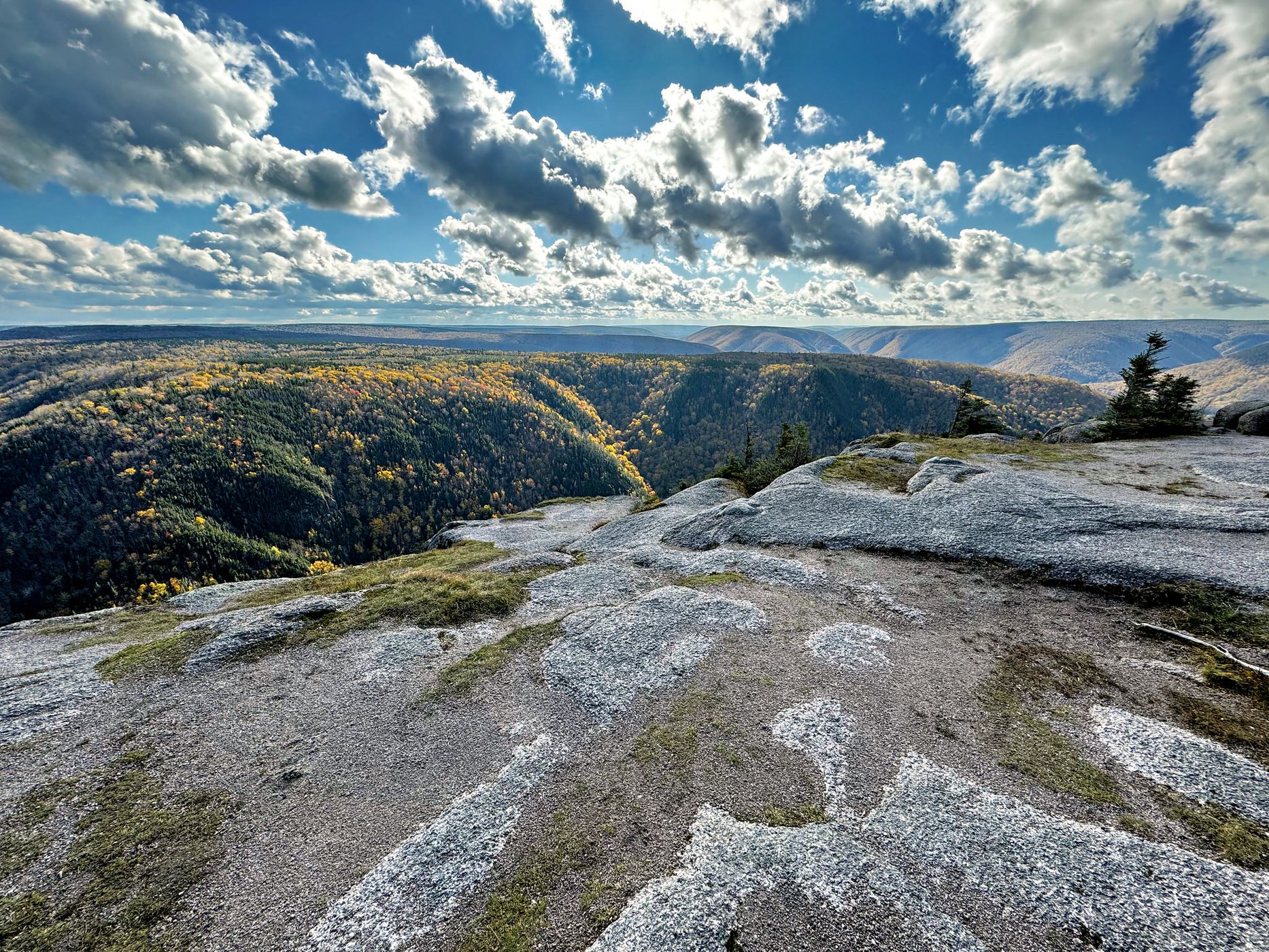
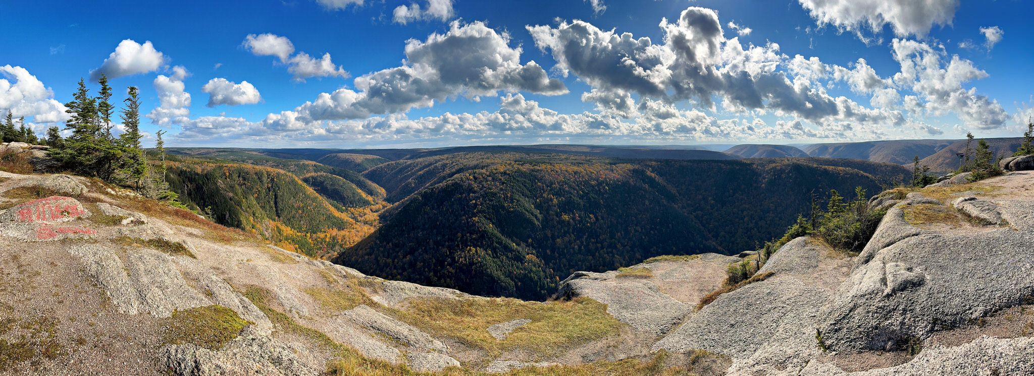
This is truly one of Nova Scotia’s hidden gems. While technically there’s no hiking to reach this site, once you arrive, you’ll be astounded by the breathtaking viewpoints overlooking the Highlands and the northeast Margaree River Valley. Some of the cliffs around Cape Clear are over 300 feet tall. Cape Clear is designated as a protected wilderness area. Just before the end of the road, there’s a small access trail to the side of Cape Clear. Towards the end of the road, there are many tracks that lead you to the tip of Cape Clear. Cape Clear is formed by large granitic outcrops that are largely devoid of vegetation. This affords you a spectacular view of the Margaree Valley, Sugarloaf, and the highlands in general. However, be cautious, as there are numerous steep cliffs all around the Cape.
Photography Tips
Autumn is undoubtedly the best time to visit, when the leaves undergo a breathtaking transformation, painting the landscape with a kaleidoscope of colors. To capture the essence of this vibrant scene, consider bringing a tripod for panoramic photography. Sunrise and sunset offer the most picturesque moments, but remember to factor in the travel time to and from the location.
Travel Information
Near Lower Middle River, take Highlands Rd (also known as Crowdis Mtn Rd) and follow it for a long time until a secondary road turns to the left. Turn left at 5146968.50 m N, 669636.73 m E and continue on this secondary road until you turn right again at 5149161.72 m N, 664198.70 m E. There are some signs for Cape Clear, but it’s best to consult a map before heading out or, even better, bring some topographic maps or GPS.
Be aware that this is a dirt road in backcountry. Watch out for deep holes, especially coming closer to Cape Clear, you may want to leave your car and walk the last one or two kilometers. You should drive up only with a 4-wheeler.
Be aware that this is a dirt road in backcountry. Watch out for deep holes, especially coming closer to Cape Clear, you may want to leave your car and walk the last one or two kilometers. You should drive up only with a 4-wheeler.
Spot Type
Outdoor
Crowd Factor
Just a few people
Best Timing
Fall
Sunrise & Sunset
06:08 - 19:57
| current local time: 18:54
Photo Themes
Landscape
nature
Panorama
wildlife
Locations
Nova Scotia
Cape Breton Island


Spot Comments (0)