
Germany Halde Brockenscheidt
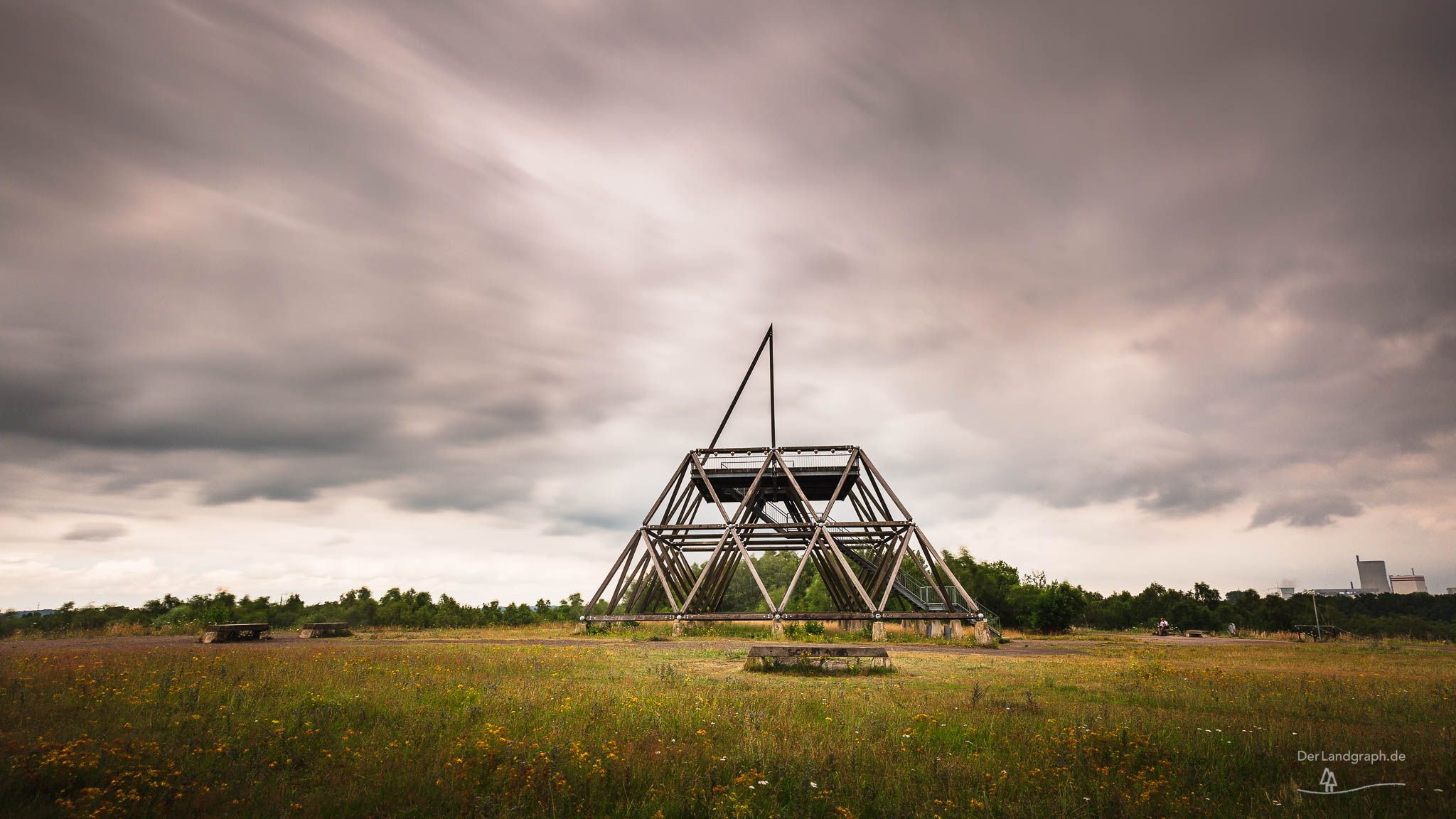
The Brockenscheidt slag heap is located next to the former Waltrop mine, which was closed in 1979. At 15 meters high, the slag heap is one of the smaller slag heaps in the Ruhr region. In 2000, the Spurwerk Tower was erected at the highest point of the slag heap. This work of art was deliberately left unfinished, as can easily be seen from the top of the pyramid-shaped sculpture. The 20-meter-high landmark features an observation platform approximately 12 meters high, accessible via a staircase.
Travel Information
Parkplatz Zeche Waltrop
Landabsatz
45731 Waltrop
Landabsatz
45731 Waltrop
Spot Type
Outdoor
Crowd Factor
Just a few people
Best Timing
All timings are equally good
Sunrise & Sunset
06:21 - 20:37
| current local time: 11:21
Photo Themes
artwork
Bergbau
Bergehalde
coal mine
Halde
Haldenkult
Haldenkultur
Industriekultur
Kohlenpott
Ruhrgebiet
Ruhrpott
slag heap
Steinkohle
Steinkohlenbergbau


Spot Comments (0)