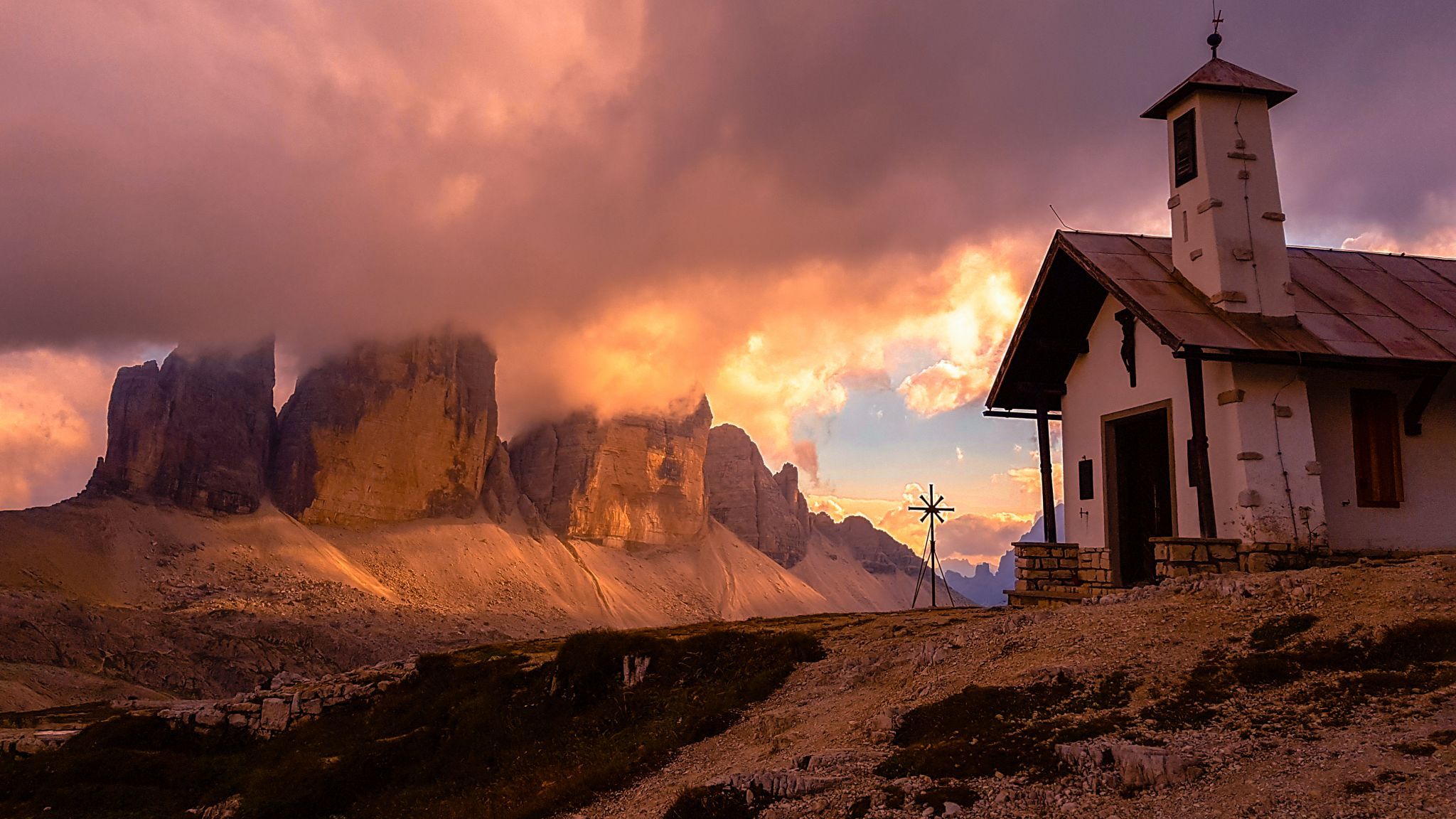


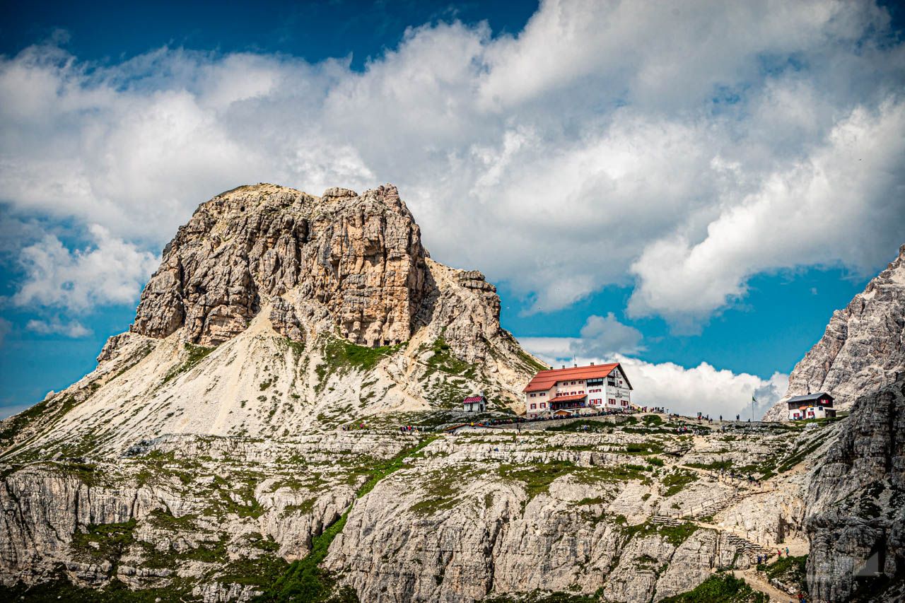

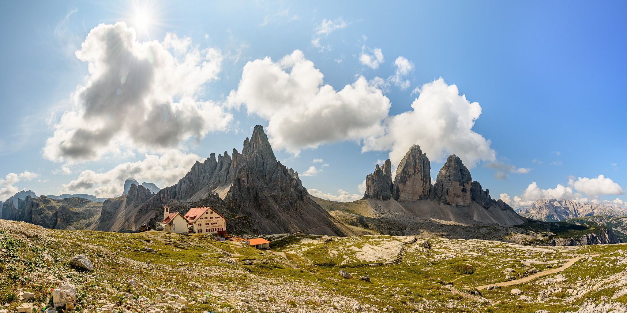


Italy Rifugio Antonio Locatelli-S. Innerkofler
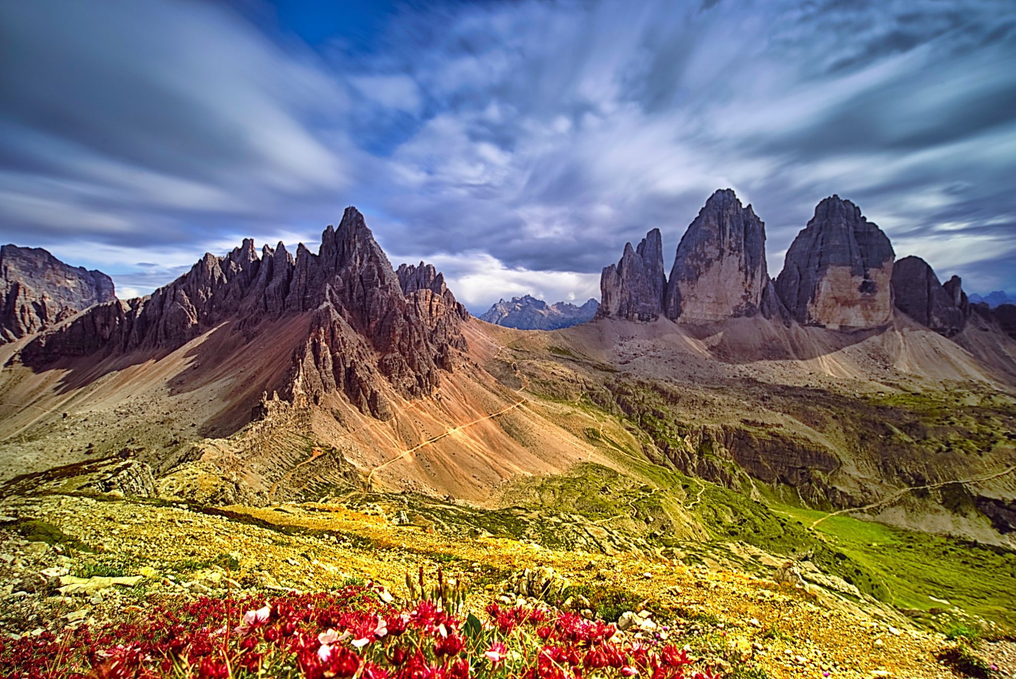
The Tre Cime di Lavaredo (Drei Zinnen) rise at the southern edge of the expansive crenellated plateau with the Langen Alm (La Grava Longa), an alpine plateau at about 2200 m to 2400 m, which forms the end of the Rienz valley (Valle della Rienza). There are three small mountain lakes, the Zinnensee. This area north of the mountains up to their peaks belongs to the municipality of Dobbiaco in South Tyrol and the Drei Zinnen Nature Park (until 2010 Natural Park Sesto Dolomites), which has been part of the UNESCO World Heritage Site since 2009.
The crest of the Tre Cime di Lavaredo, running in a west-east direction, forms the border to the municipality of Auronzo di Cadore in the province of Belluno, which is also the German-Italian language border. To the northeast, this ridge continues to the 2454 m high Paternsattel (Forcella Lavaredo), where it turns to the north to the mountains Passportenkopf (Croda di Passaporto, 2719 m) and Paternkofel (Monte Paterno, 2744 m). In the west, it continues via the Forcella Col di Mezzo (2315 m) to the crenellated peak (Col di Mezzo) (2254 m) and on to the 2252 m high cat ladder head (Croda d' Arghena).
The crest of the Tre Cime di Lavaredo, running in a west-east direction, forms the border to the municipality of Auronzo di Cadore in the province of Belluno, which is also the German-Italian language border. To the northeast, this ridge continues to the 2454 m high Paternsattel (Forcella Lavaredo), where it turns to the north to the mountains Passportenkopf (Croda di Passaporto, 2719 m) and Paternkofel (Monte Paterno, 2744 m). In the west, it continues via the Forcella Col di Mezzo (2315 m) to the crenellated peak (Col di Mezzo) (2254 m) and on to the 2252 m high cat ladder head (Croda d' Arghena).
Photography Tips
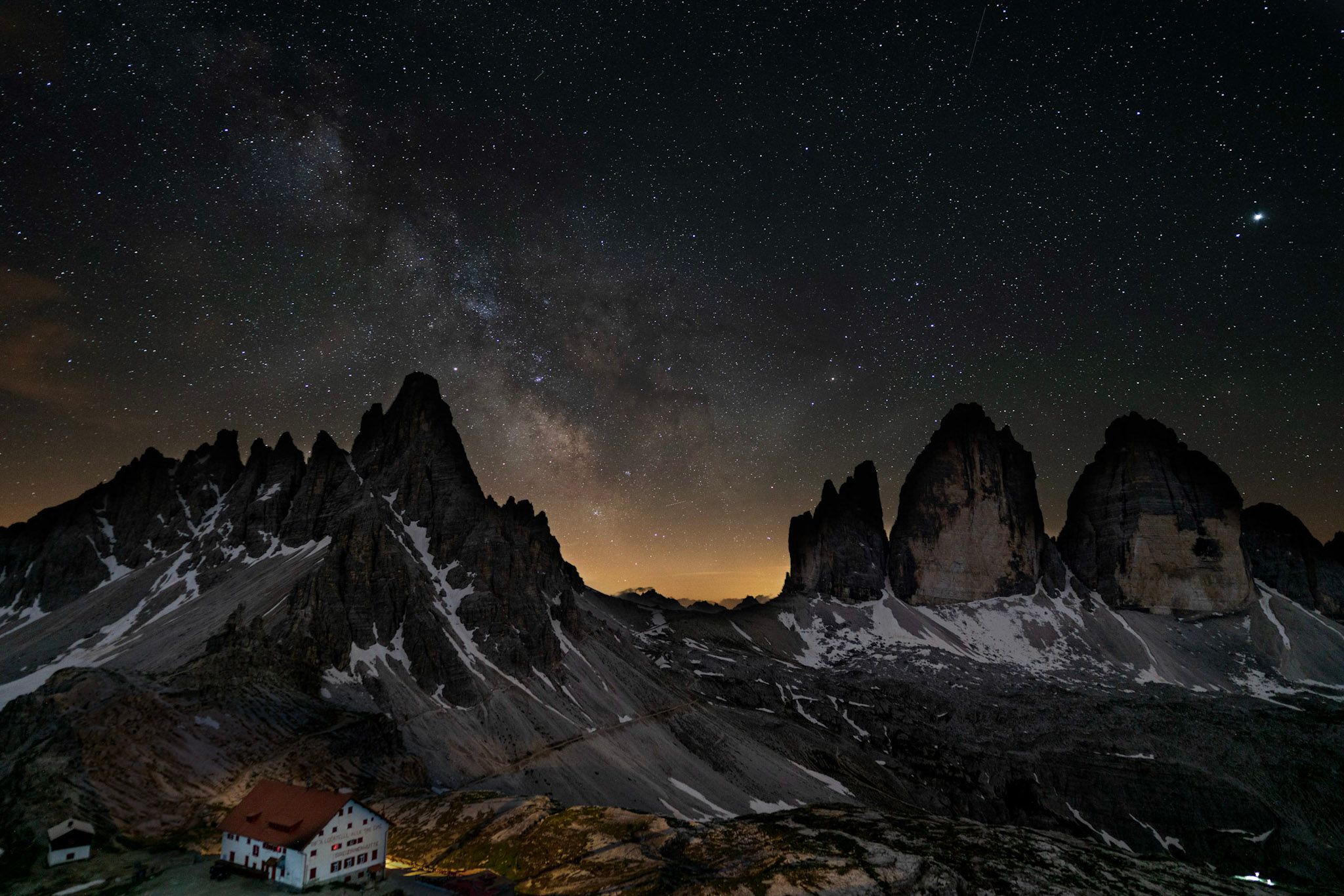
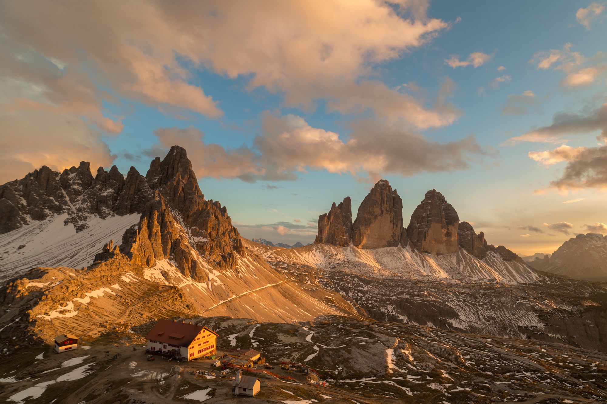
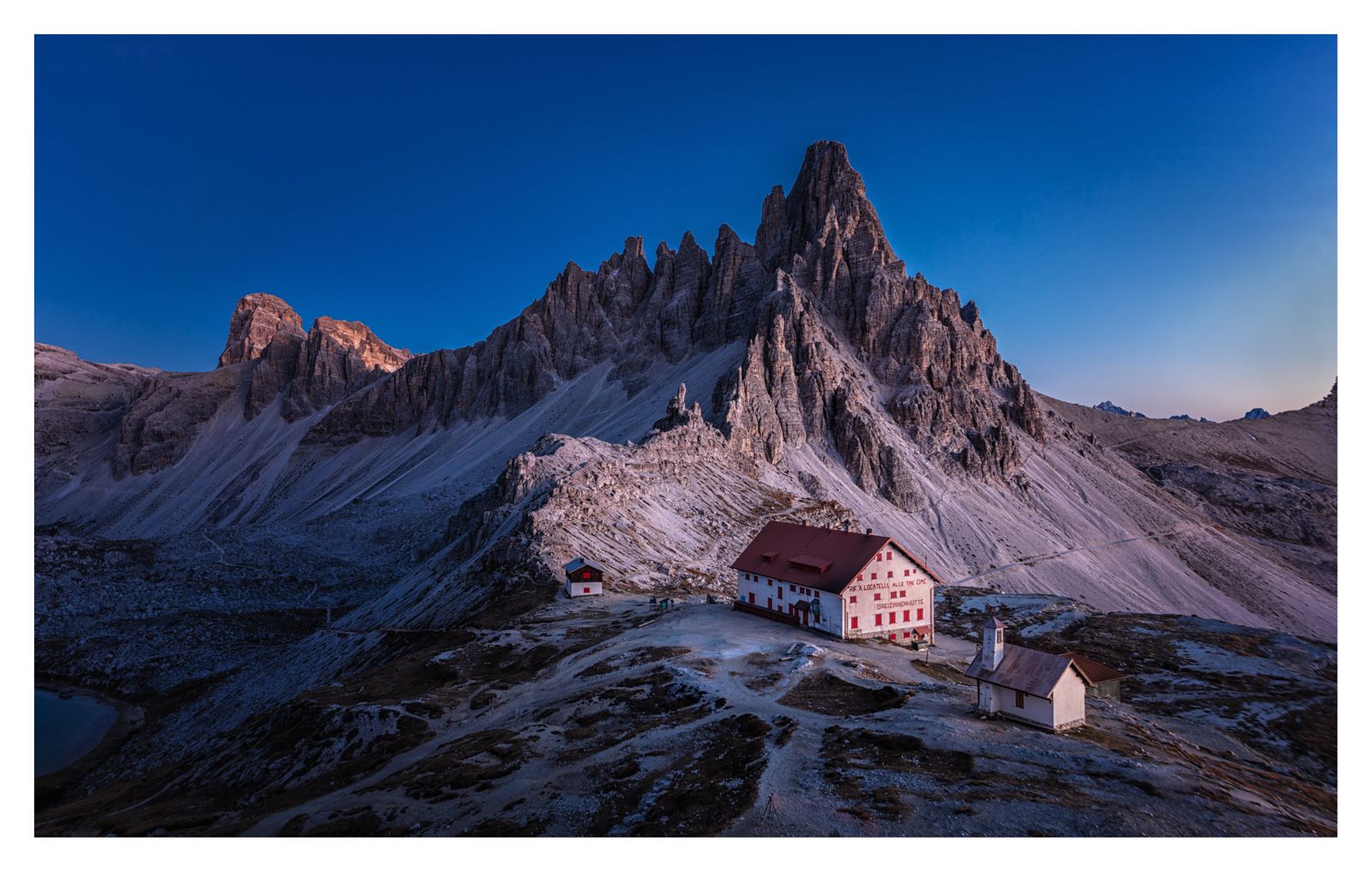
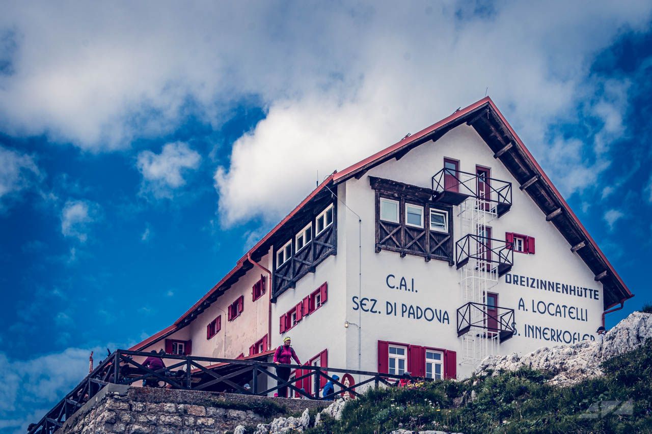
All pictures are taken in the vicinity (less than 5 minutes on foot) of the Refugio Antonio Locatelli-S. Innerkofler. The chapel stands right next to the hut and the caves are a little up the mountain if you continue from the hut passing the chapel.
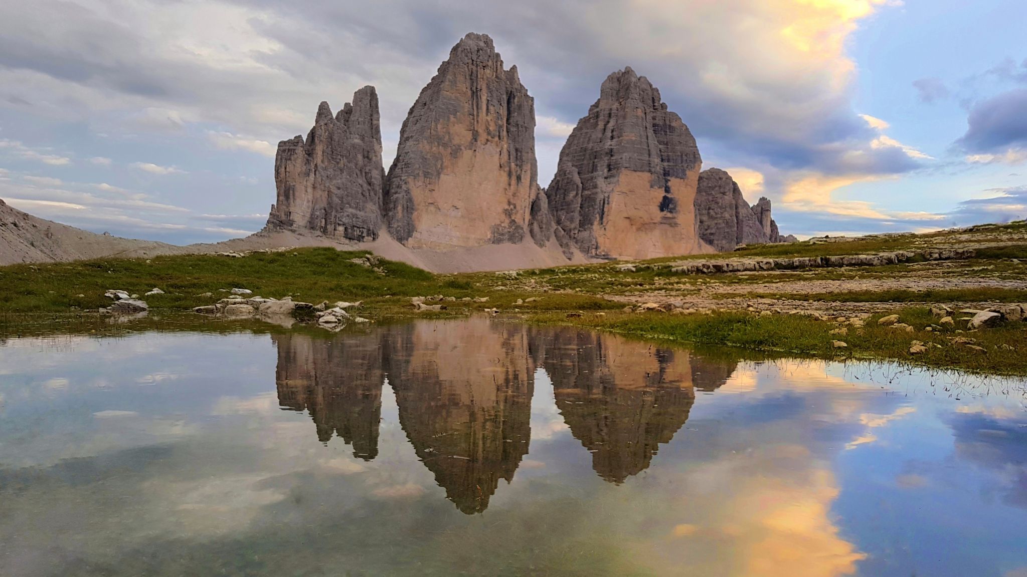
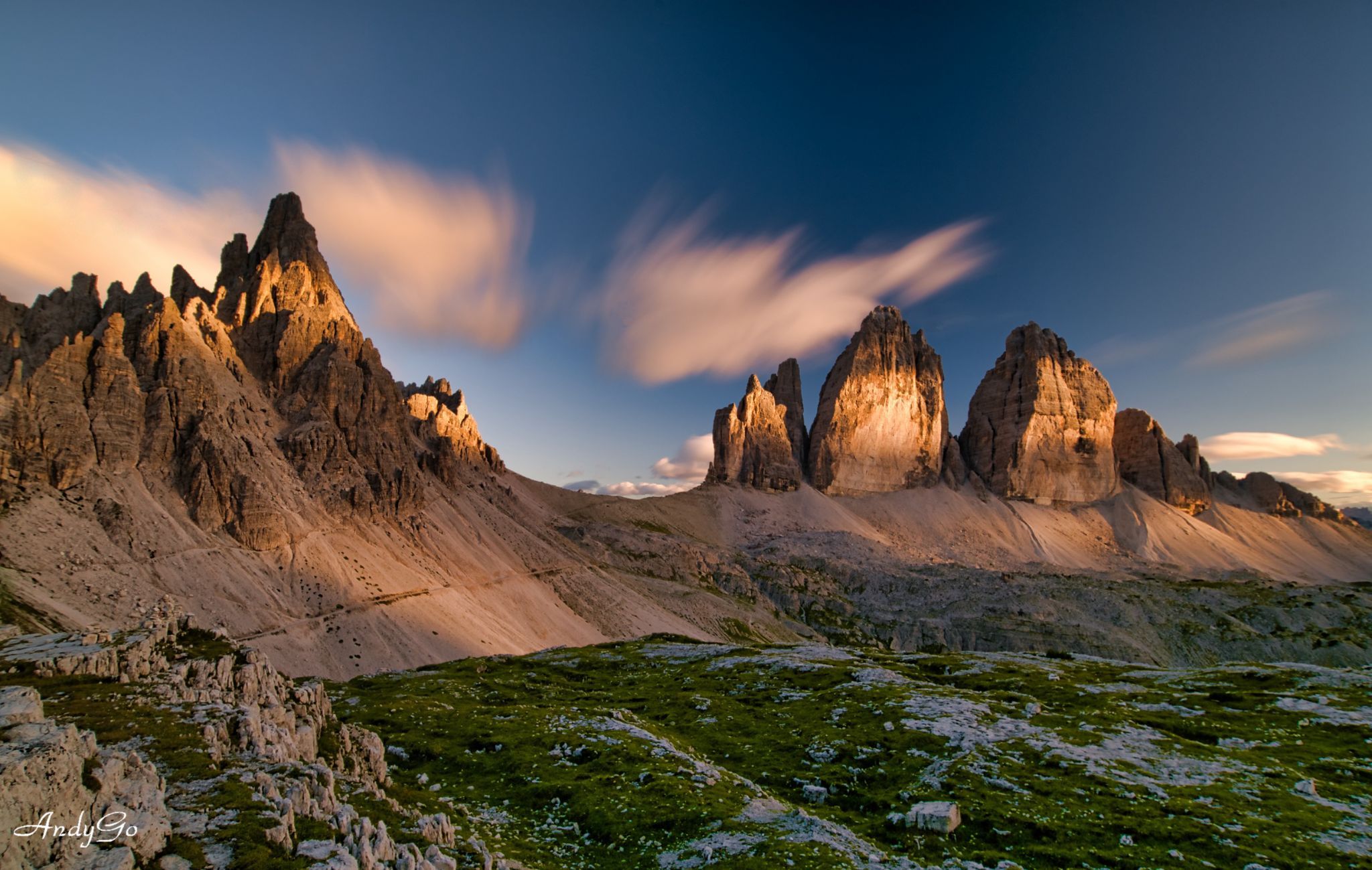
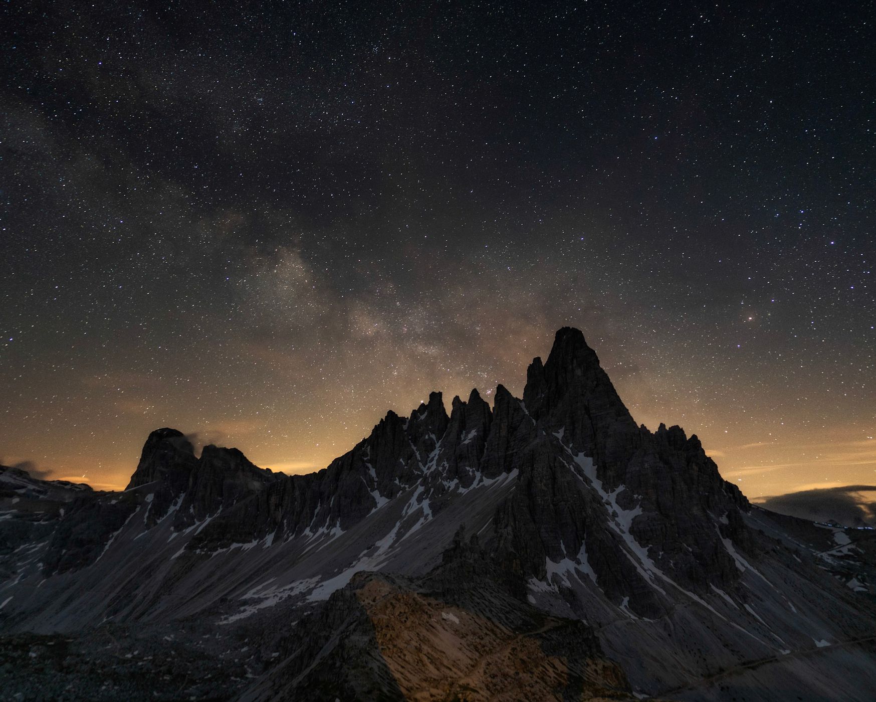
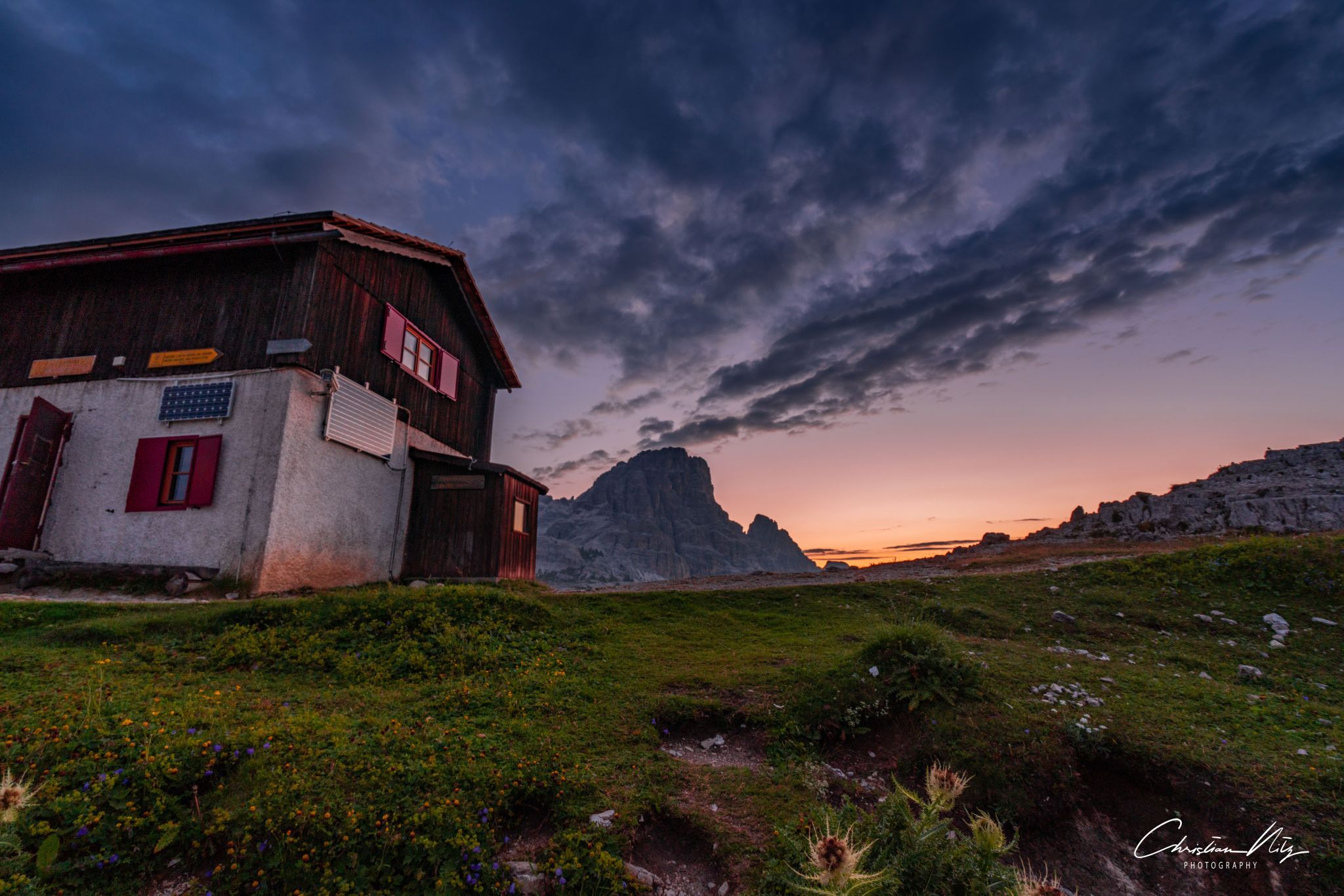
The Tre Cime di Lavaredo has its charm at any time of day. Be it in the sunrise and sunset or also in a radiant blue sky. When they scratch on the cloud cover or after heavy rainfall when large puddles form in front of the hut in which the Tre Cime di Lavaredo is reflected.
The Tre Cime di Lavaredo has its charm at any time of day. Be it in the sunrise and sunset or also in a radiant blue sky. When they scratch on the cloud cover or after heavy rainfall when large puddles form in front of the hut in which the Tre Cime di Lavaredo is reflected.
Travel Information
- Standard route from the Auronzo hut (2320 m, car park, bus) via Lavaredo hut and Paternsattel, (trail 101, walking time 1.5 hours, mountain bike route)
- From the Auronzo hut (2320 m) via Forc. de Col de Mezo (path 105 or Dolomitenhöhenweg 4, walking time 2 hours)
- From Sesto via Fischleinboden (parking lot, public bus) to the Talschlusshütte (2 hours walking time) and further through the Altensteintal (path 102, total walking time 4 hours)
- From the Höhlensteintal (parking lot, public bus Dobbiaco-Cortina d' Ampezzo) through the Rienz valley (path 102, walking time 3.5 hours)
- From the Sextental (route bus) through the Innerfeldtal (parking lot) (path 105 or Dolomitenhöhenweg 4, walking time depending on the starting point)
Spot Type
Outdoor
Crowd Factor
A decent amount of people
Best Timing
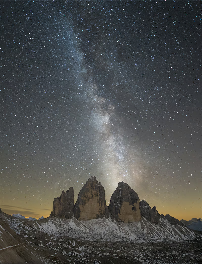
Sunset in summer
Sunrise & Sunset
05:20 - 21:09
| current local time: 04:33
Photo Themes
Dreizinnehütte
Dreizinnen
Mountains
Locations
Dolomites


Spot Comments (6)