Safi, Lebanon
licensable
This photo is copyrighted by the author.
Thank you for respecting the rights and efforts of our photographers. Please contact the author for further information.

Lebanon Safi

  • Please log in or sign up for free to see the GPS coordinates & weather for this photo spot
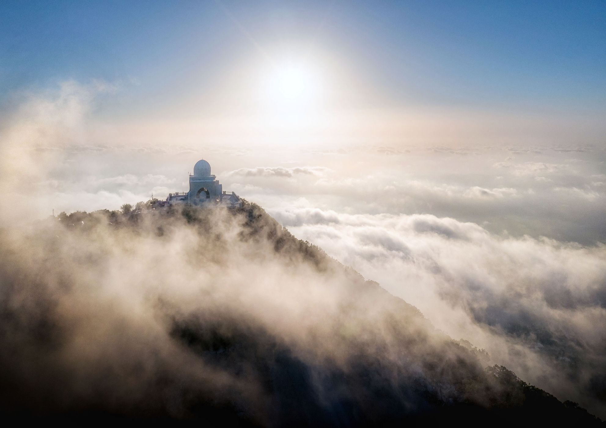
Mount Safi is one of the highest spots in south Lebanon. From there you can see the coastline and pretty much every spot around the mountain. In summer/autumn, you can see a cloud formation every day before sunset. At these spots, you can stand "above the clouds". The building seen in the image is the shrine of Safi, a prophet who used to live in the mountains.

Photography Tips

If you want to use a drone, you have to get a special permit from the Lebanese army. For more information, just google "drone laws in Lebanon".

Travel Information

You can get to the spot using a car, but the road is very rough.
Spot Type Drone
Crowd Factor Just a few people
Best Timing Sunset
Sunrise & Sunset 06:23 - 18:39 | current local time: 02:26
Photo Themes Landscape
Locations Safi

Get the exact geo-position for this spot

Log in to see the GPS coordinates, sun directions, and the map for this photo spot. Or simply bookmark it along with other spots to plan your next trip.

Spot Comments (0)

Please log in or sign up for free to leave a comment or ask a question.

Ratings (1) starstarstarstarstar

starstarstarstarstar
1
starstarstarstarstar
0
starstarstarstarstar
0
starstarstarstarstar
0
starstarstarstarstar
0

Popular photo spots in this region

Thank you Ali Dawi for creating this photo spot in Lebanon and Mia Pflieger for improving it with additional photos or content.
Imprint & Contact © Locationscout 2024 Privacy / Terms