")

Sweden Hällingsåfallet
Hällingsåfallet is a waterfall and a nature reserve in Jämtland County in Sweden. It is part of the European Union-wide Natura 2000 network.
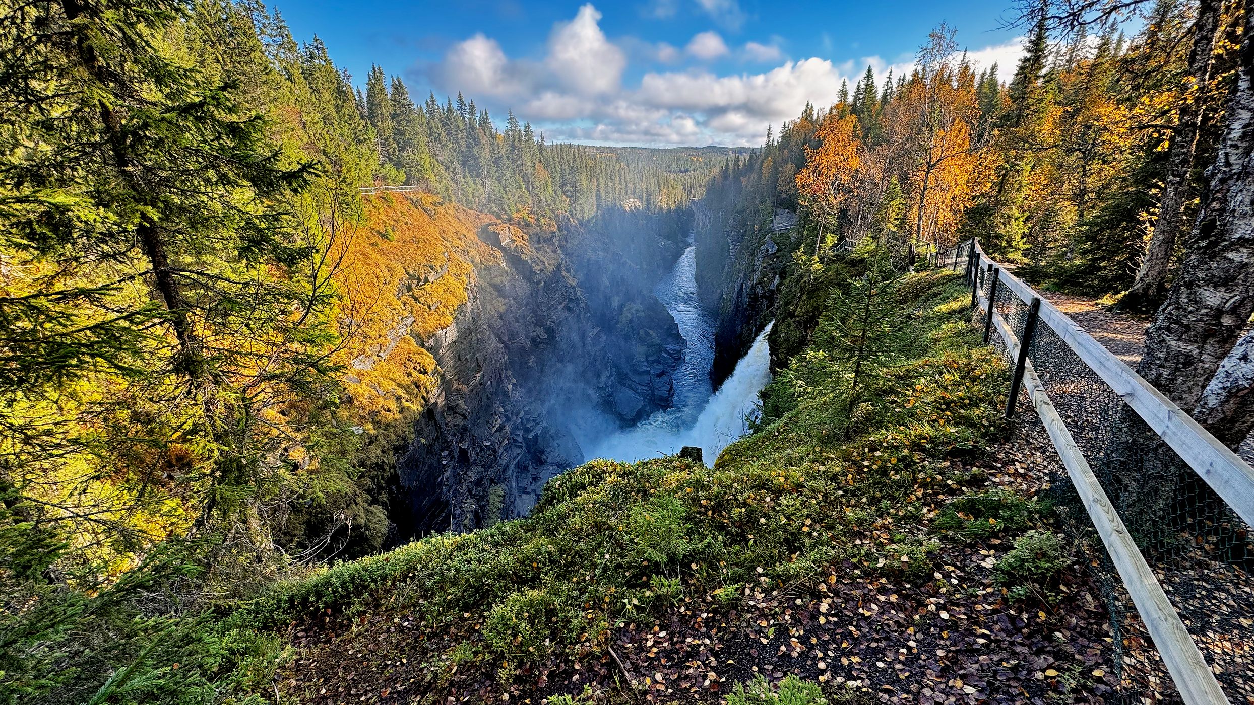
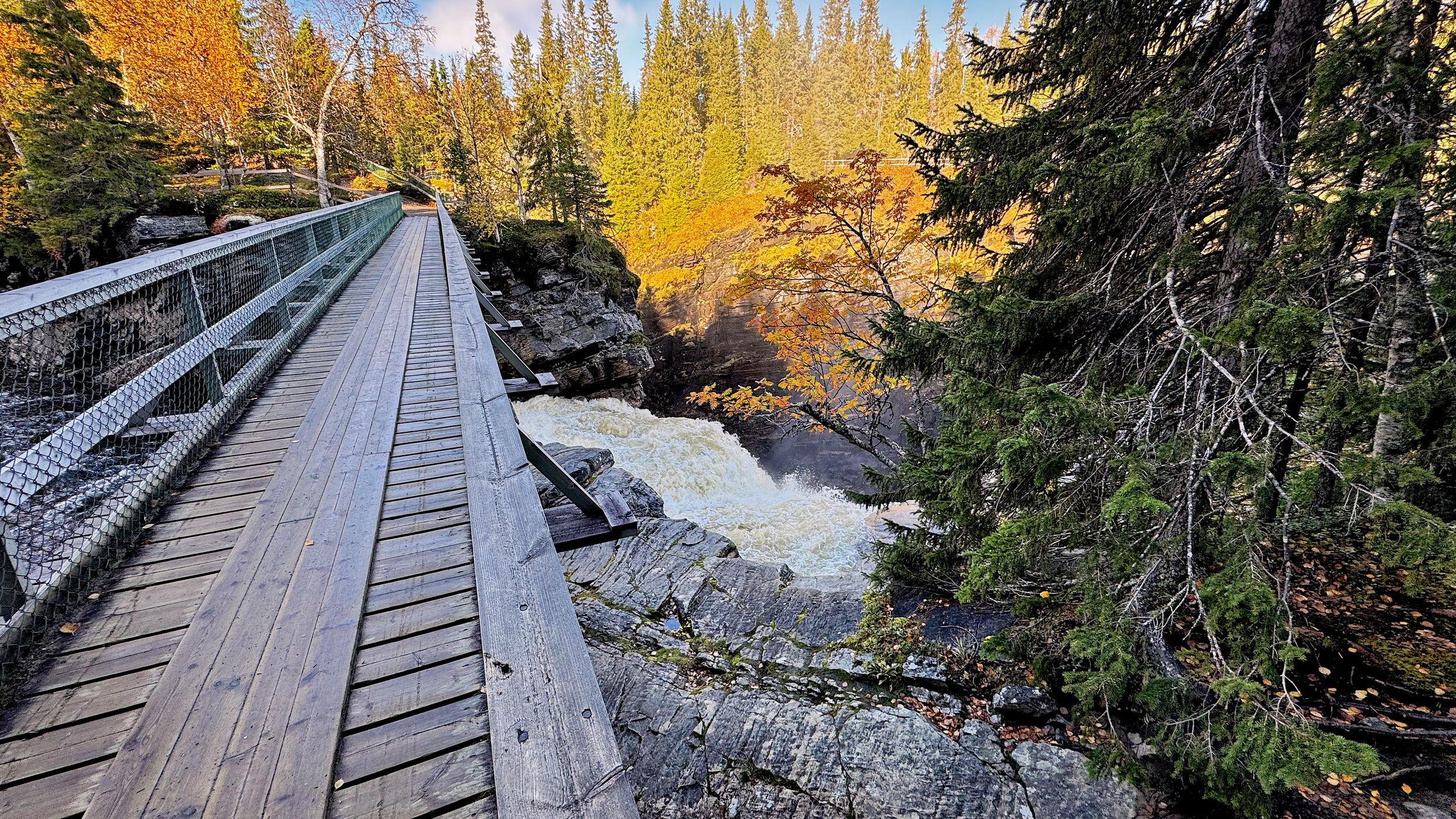
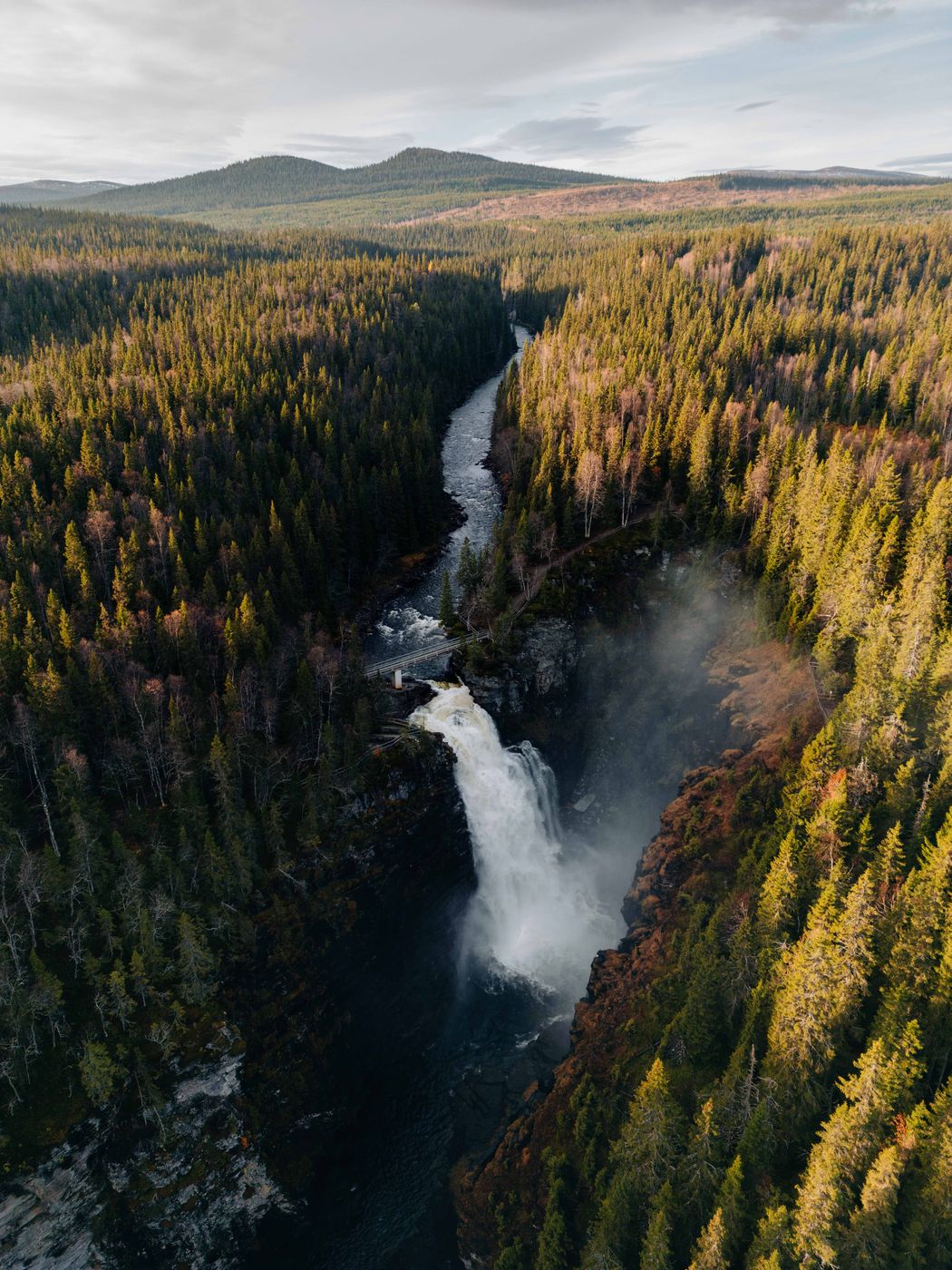
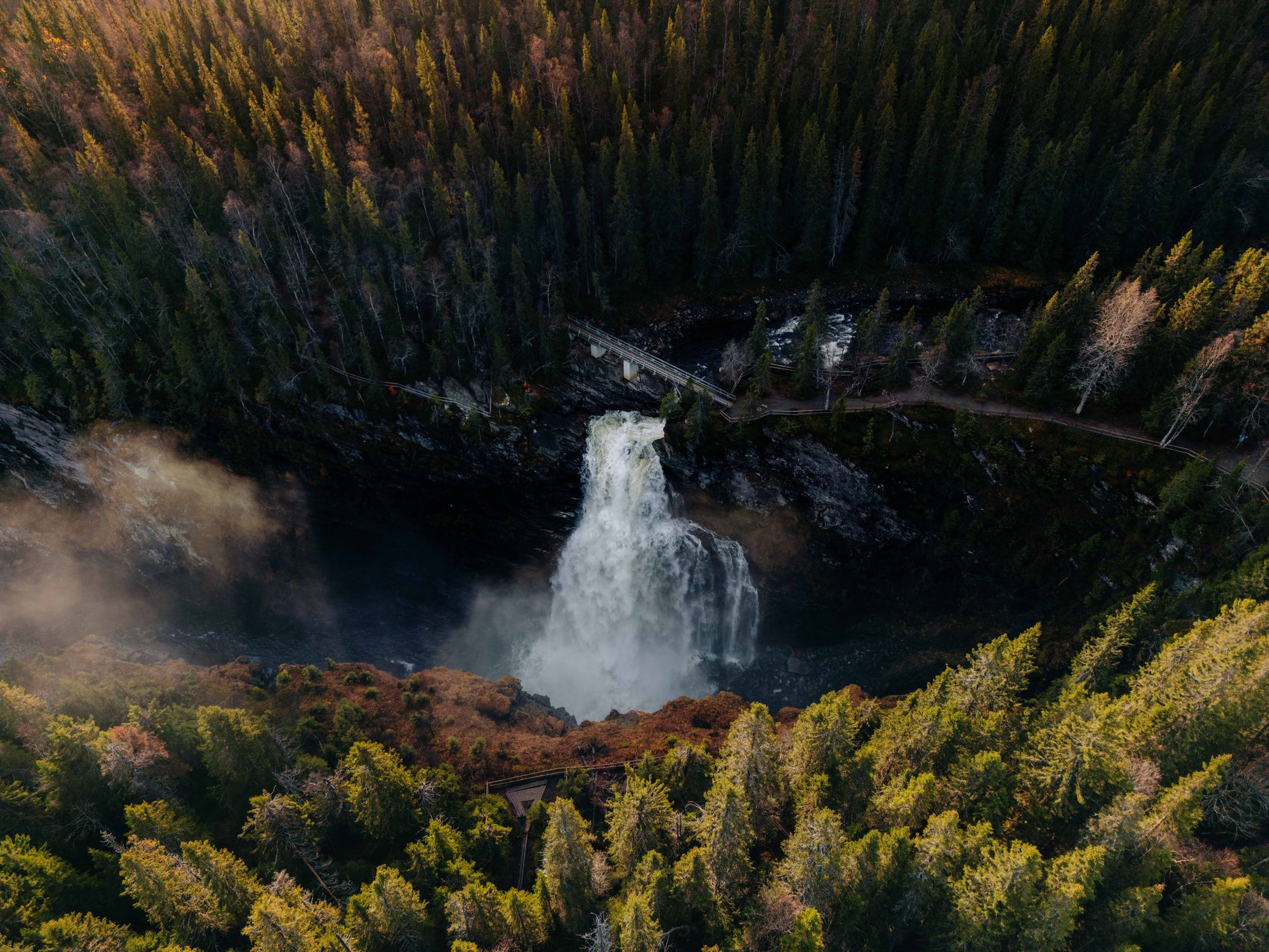
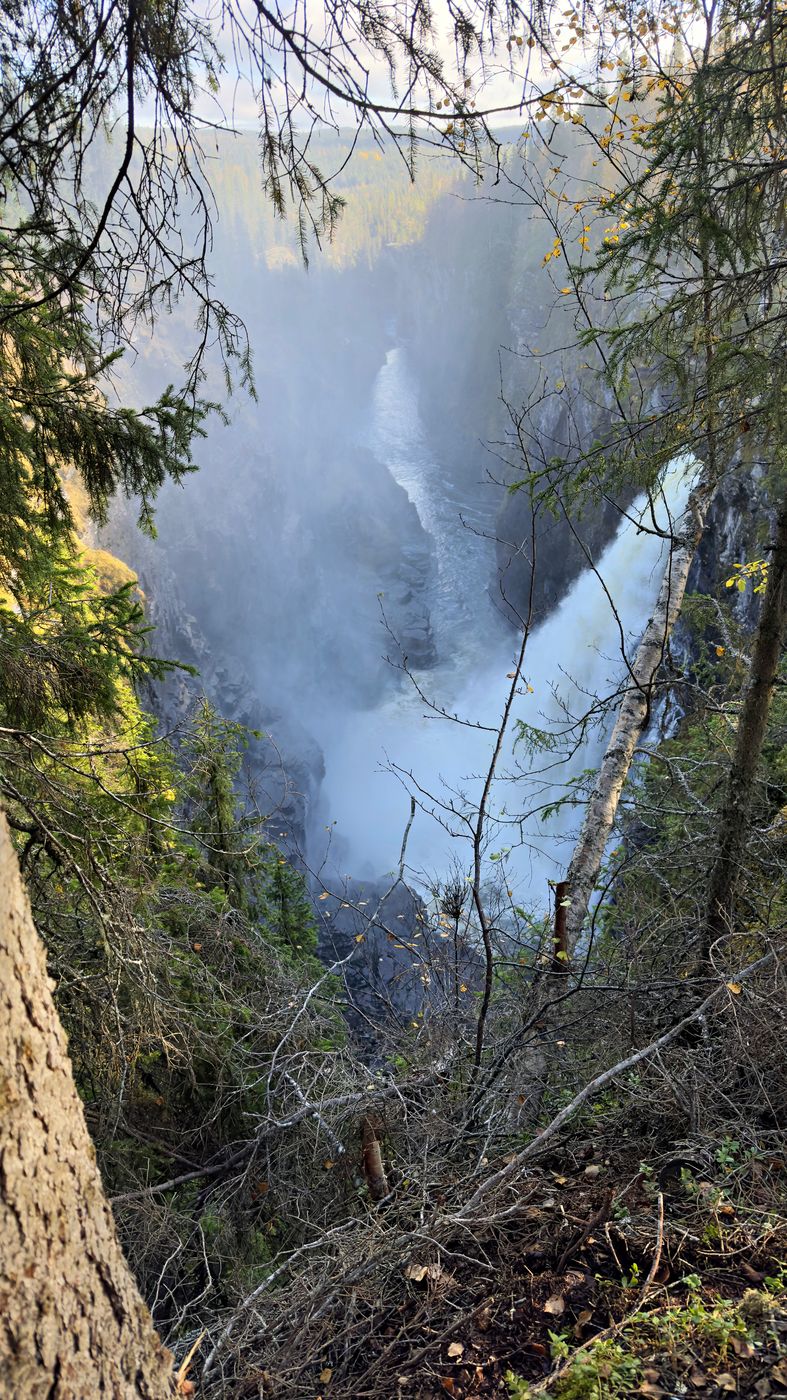
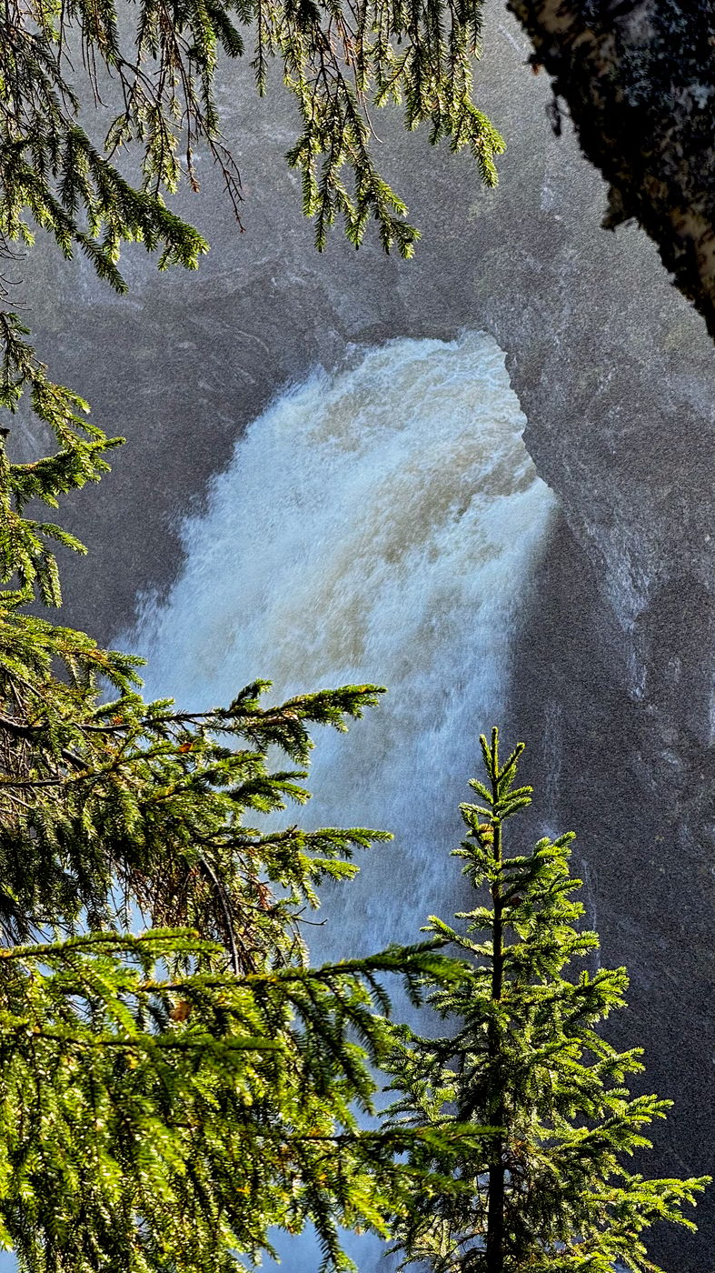
The nature reserve is centred on Hällingsåfallet waterfall and the river canyon into which it discharges. The nature reserve is located at an altitude of around 330 m (1,080 ft) to 400 m (1,300 ft) above the sea level, and the waterfall itself is 43 m (141 ft) high. The canyon into which it falls is circa 800 m (2,600 ft) long, making it the longest in Sweden and between 15 m (49 ft) and 60 m (200 ft) wide. The canyon was not formed by the current stream running there, but rather during the last ice age, when the melting ice eroded what was already a crack in the bedrock here. However, it cannot be excluded that the canyon is even older.
(Wikipedia)
Photography Tips
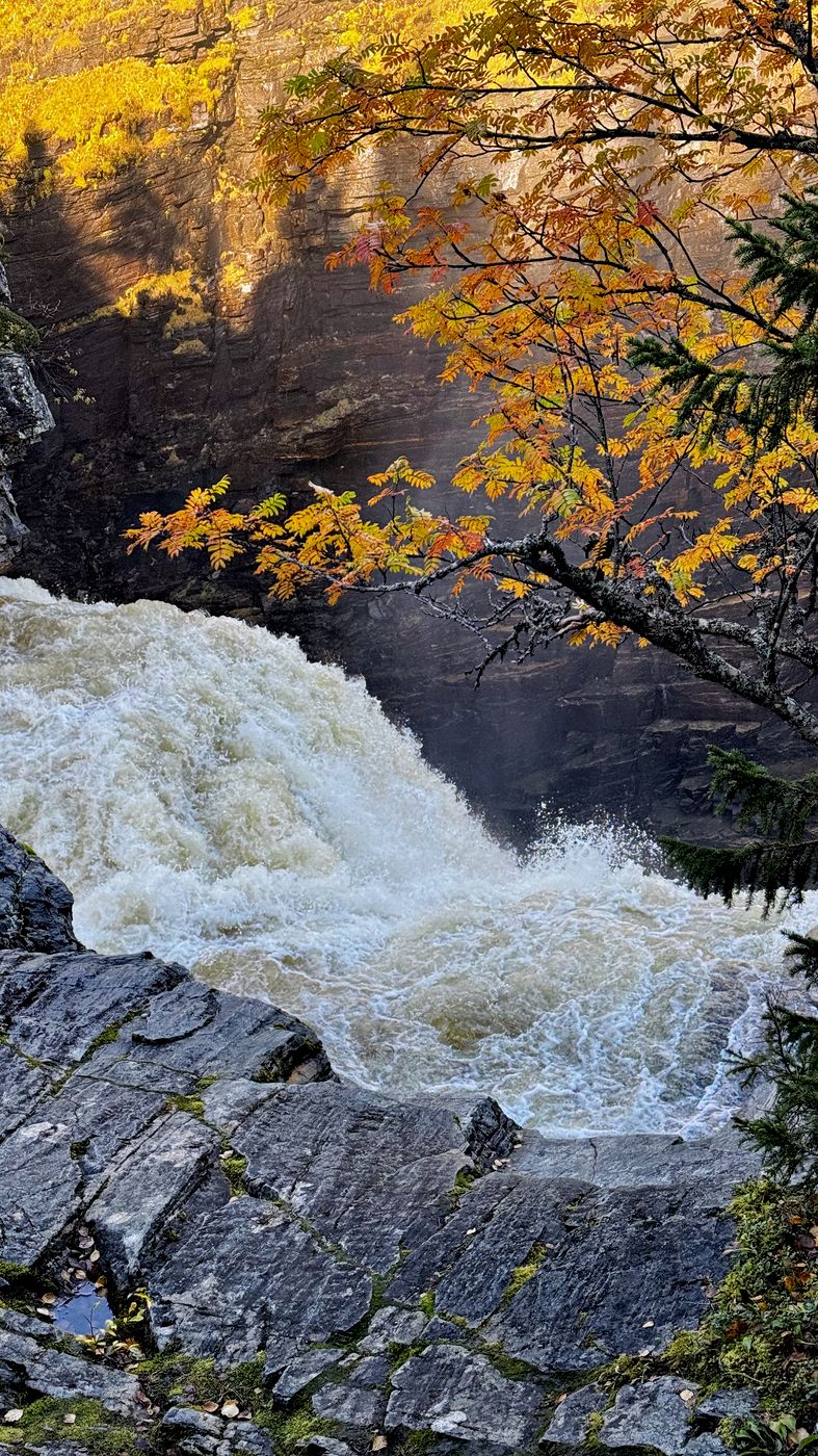
The Hällingsån river plunges down a 40-meter drop. The water splashes down into Sweden's longest canyon. In winter, very exciting and strange ice blocks with strange shapes are formed.
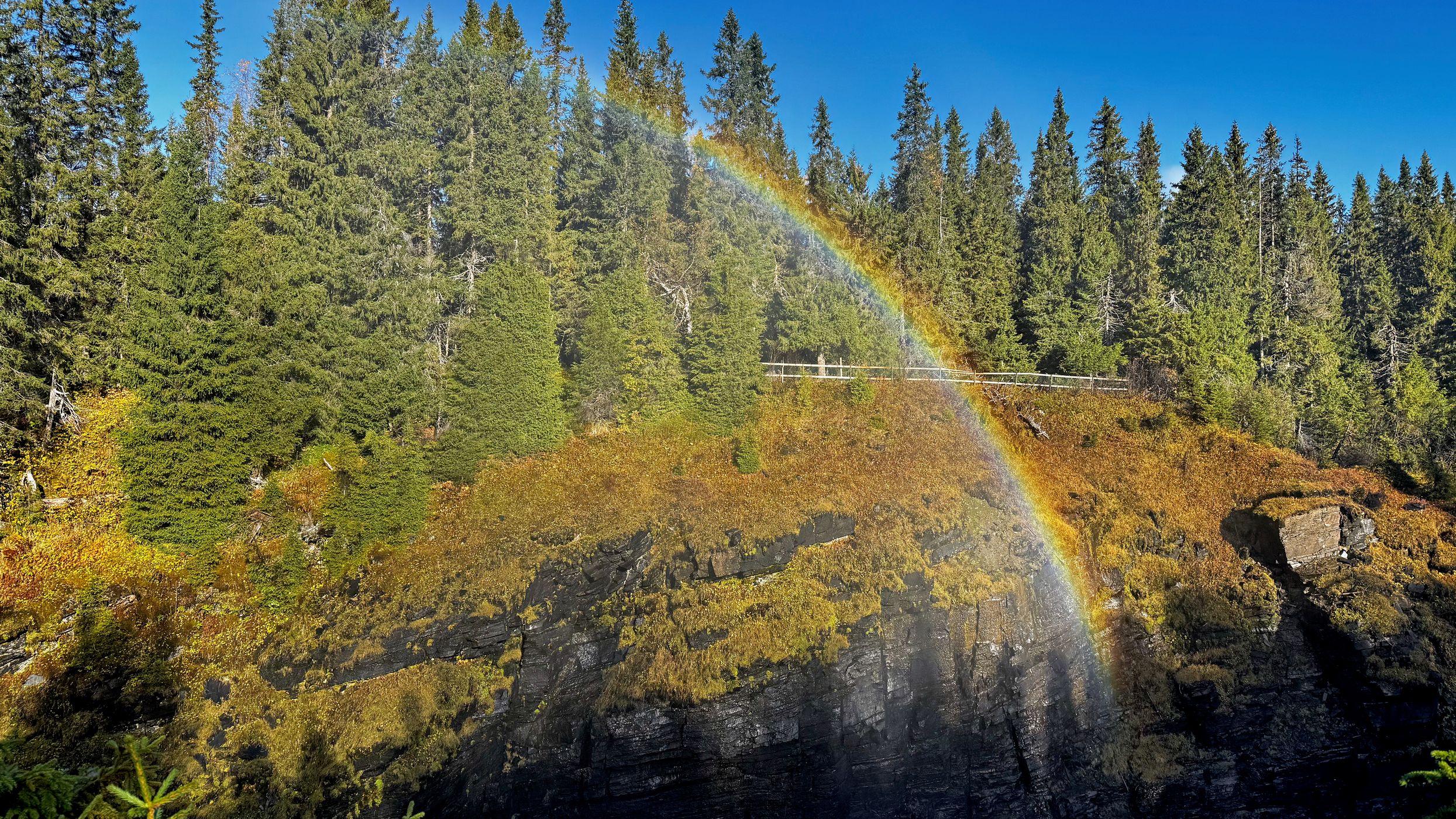
The humidity is very high. It is foggy around the falls. There are certain mosses and lichens that need the damp mist to grow and live a good life near the falls.
The humidity is very high. It is foggy around the falls. There are certain mosses and lichens that need the damp mist to grow and live a good life near the falls.
Travel Information
Gravelroad near Gäddede
64°21′02″N 14°23′27″E
64°21′02″N 14°23′27″E
Spot Type
Outdoor
Crowd Factor
Just a few people
Best Timing
All timings are equally good
Sunrise & Sunset
02:27 - 23:44
| current local time: 23:10
Photo Themes
Canyon
Natural Landscape
Riverside
Waterfall
Woodland
Locations
Vildmarksvägen
Gäddede
Spot Comments (0)