")
Sweden Döda fallet – the dead falls
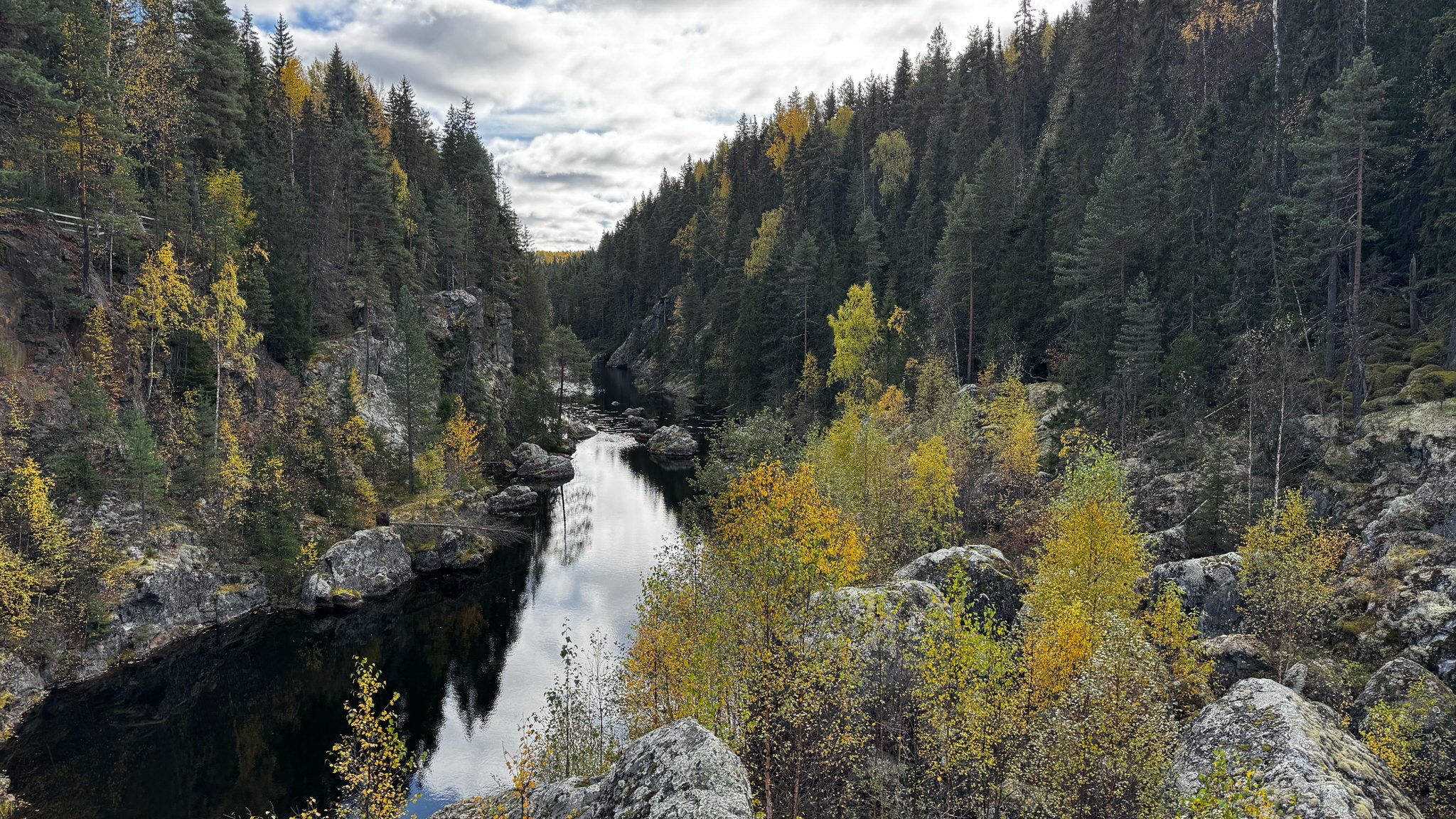
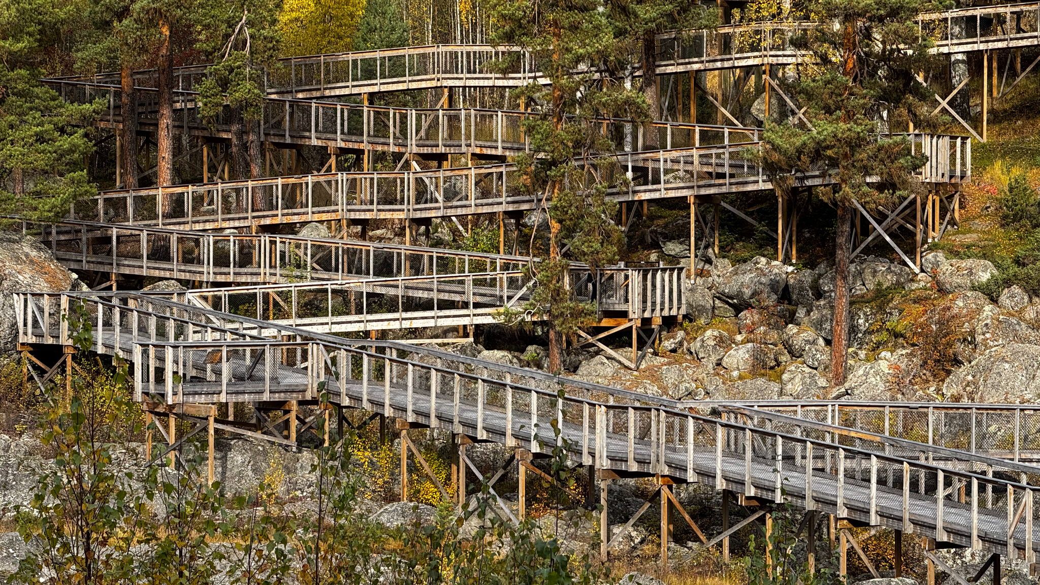
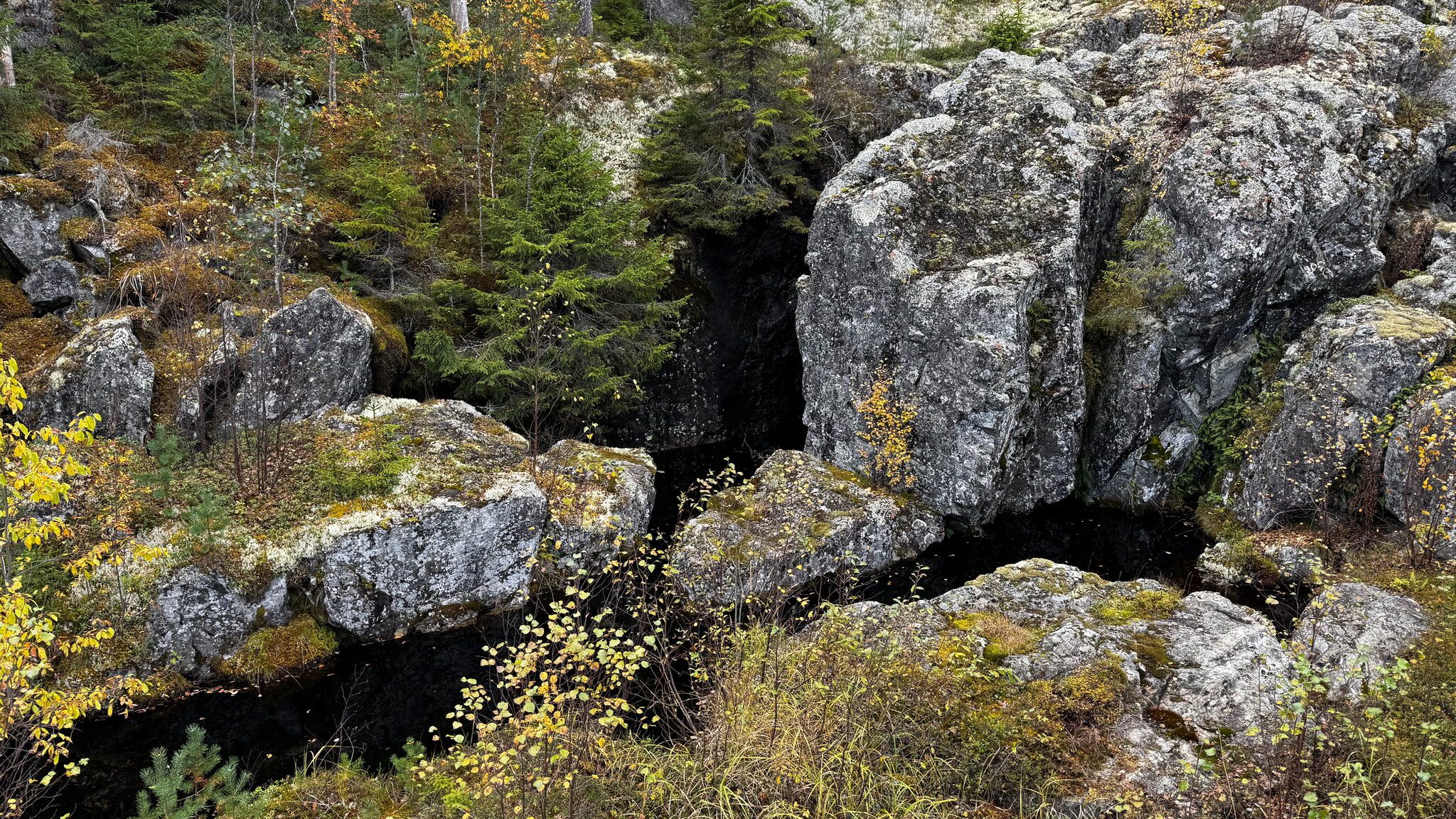
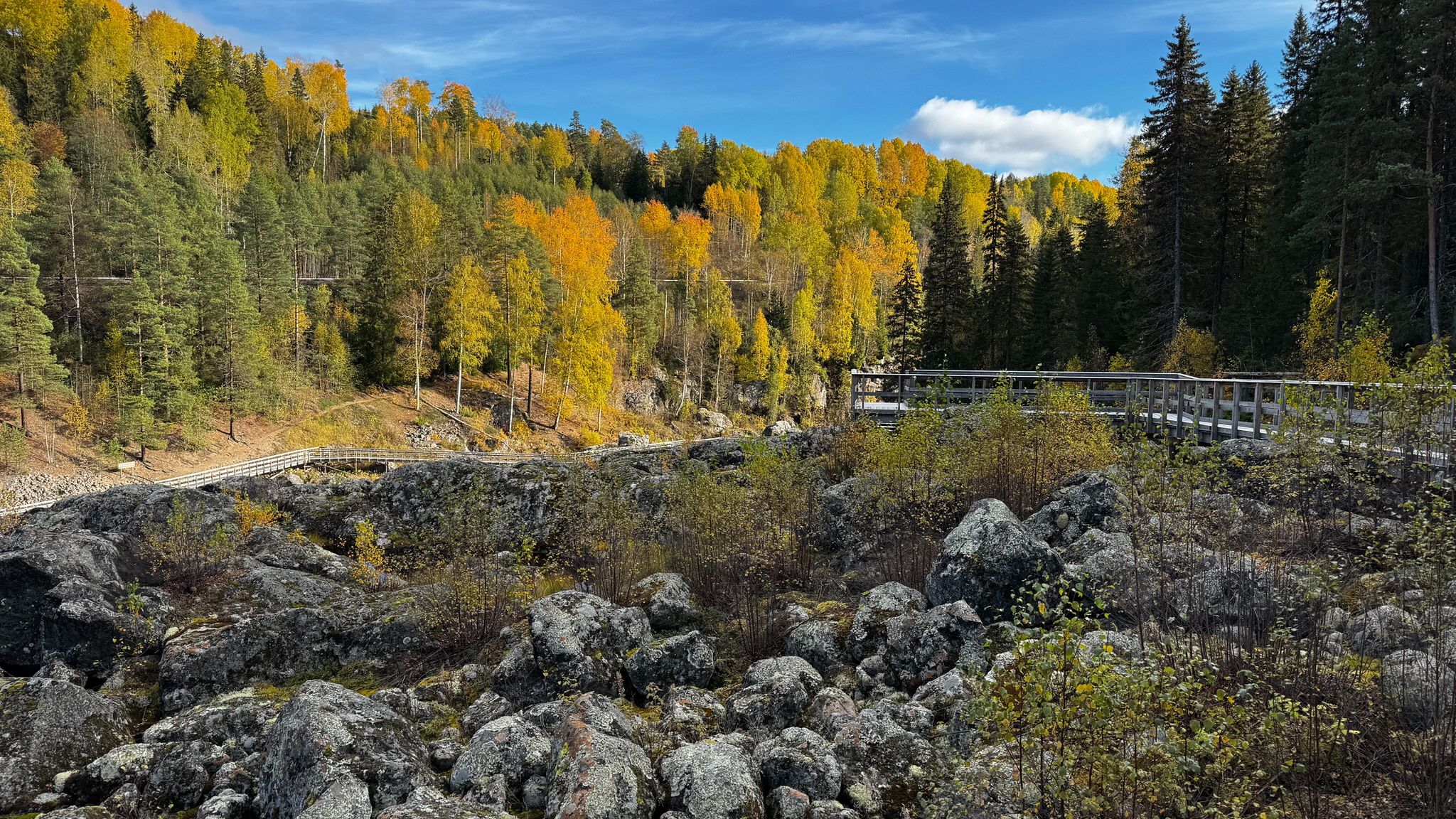
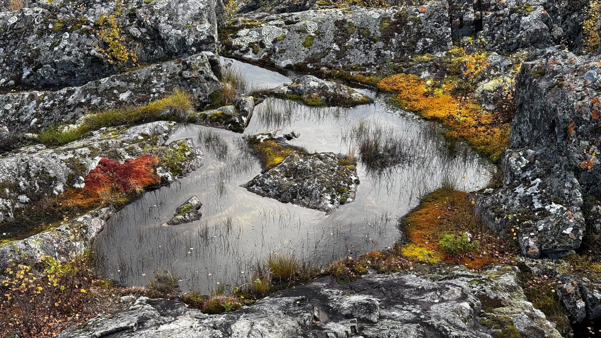
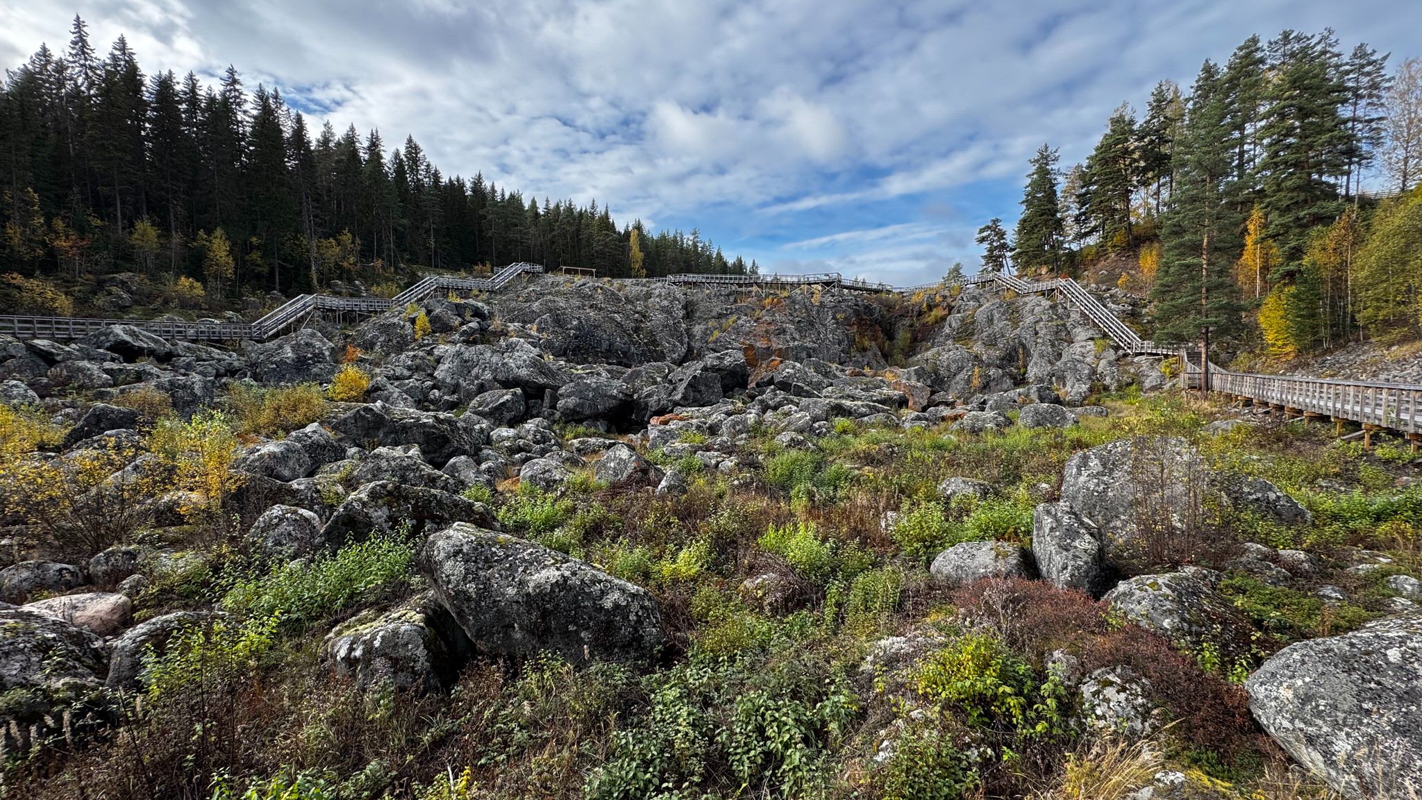
You will find multiple photo opportunities. There are boardwalks that lead you through the former waterfall, so you stroll along the riverbed.
Döda fallet was protected as a natural monument in 1926. The nature reserve was established in 1983 and covers 31 hectares. The aim of preserving Döda fallet and the riverbed is so its geological and cultural heritage values last for future generations. The nature reserve also helps encourage people to discover the natural world. The land is owned by the state and private landowners. The reserve is managed by the County Administrative Board of Jämtland.
A catastrophically clever idea
A man called Magnus Huss was employed to manage the digging of a channel, so that some of the water in Indalsälven (the river) would take a slower route, through a gravel esker, past Storforsen. But one night, in June 1796, the esker collapsed and the lake water from Ragundasjön (The lake) flooded through the channel. The water carried away trees, houses, barns, sawmills and roads. Ragundasjön was completely drained in four hours!
Afterwards, there were dead salmon hanging in the trees, but thankfullyno people were killed.
(https://dodafallet.se/)
Photography Tips
You can play with all kinds of focal length and lenses. It's like a photography playground. You can take panoramic as well as detail shots all over the place. Using a tripod is always a good idea.
Travel Information
Free parking.
Döda fallet
Västerede Döda Fallet 181
840 73 Bispgården
Döda fallet
Västerede Döda Fallet 181
840 73 Bispgården
Spot Type
Outdoor
Crowd Factor
A decent amount of people
Best Timing
All timings are equally good
Sunrise & Sunset
04:52 - 20:51
| current local time: 10:59
Photo Themes
Boardwalk
boulders
nature
riverside
Locations
Bispgården
Döda fallet
Spot Comments (0)