
USA Goat Rocks Wilderness
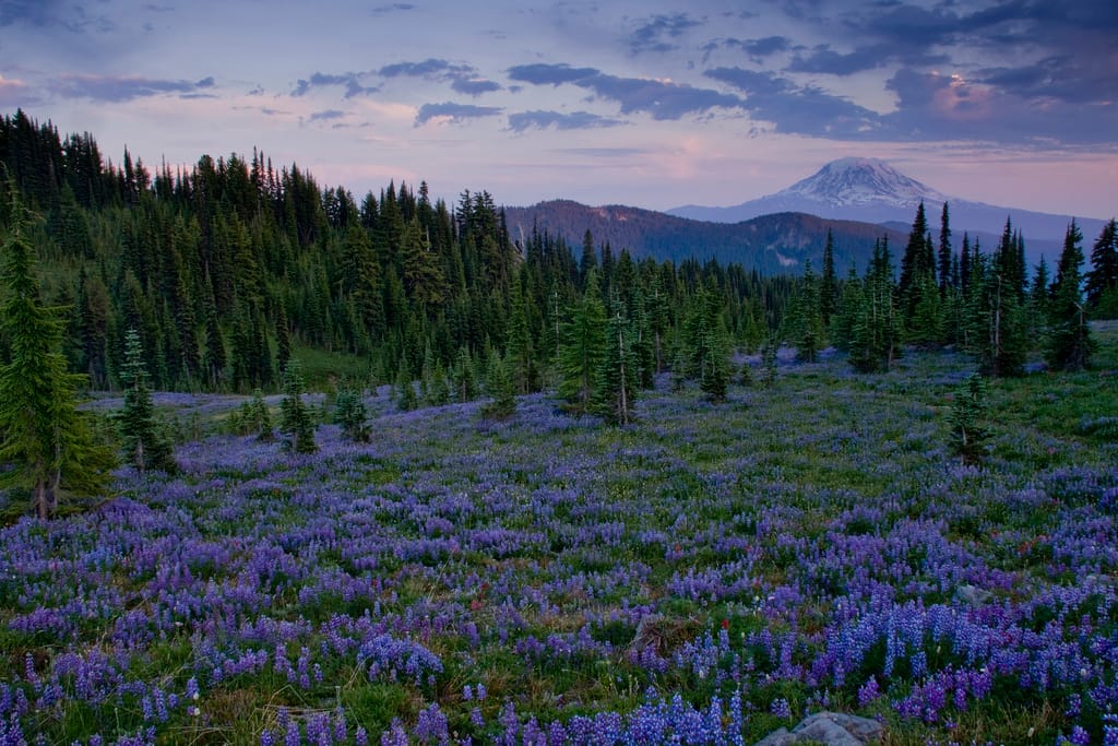
Amazing scenery - jaw dropping views, miles of wildflower displays.
Due to the distance this location is best enjoyed as an overnight backpacking trip. 16 miles round trip. 1200 feet elevation gain. Camp sites available on first comes, first served basis.
Due to the distance this location is best enjoyed as an overnight backpacking trip. 16 miles round trip. 1200 feet elevation gain. Camp sites available on first comes, first served basis.
Photography Tips
Come in the summer when miles of lupine and other wildflower carpet the meadows.
Travel Information
From Randle, drive east on Hwy 12. Two miles before Packwood, turn south on FR 21 - the Johnson Creek Road. Go 15.5 miles on FR 21 to FR 2150 (signed Chambers Lake Campground). Take 2150 about 3 miles to spur road 2150-040 - go right, then right again on spur road 2150-405. The trailhead is at road's end, signed "Berry Patch." Northwest Forest Pass required.
Spot Type
Outdoor
Crowd Factor
Lots of people
Best Timing
Summer
Sunrise & Sunset
06:08 - 20:01
| current local time: 19:02
Photo Themes
Mountains
Purple
Sunset
volcano
wildflowers
Locations
Cascades
Goat Rocks Wilderness
Packwood


Spot Comments (0)