Burren, Ireland
Reinhard Prinzmeier
Reinhard Prinzmeier www.herumkommer.de/uns…
licensable
Burren, Ireland
Reinhard Prinzmeier
Reinhard Prinzmeier www.herumkommer.de/uns…
licensable
Burren, Ireland
Reinhard Prinzmeier
Reinhard Prinzmeier www.herumkommer.de/uns…
licensable
Burren, Ireland
Reinhard Prinzmeier
Reinhard Prinzmeier www.herumkommer.de/uns…
licensable
Burren, Ireland
Reinhard Prinzmeier
Reinhard Prinzmeier www.herumkommer.de/uns…
licensable
This photo is copyrighted by the author.
Thank you for respecting the rights and efforts of our photographers. Please contact the author for further information.

Ireland Burren

  • Please log in or sign up for free to see the GPS coordinates & weather for this photo spot
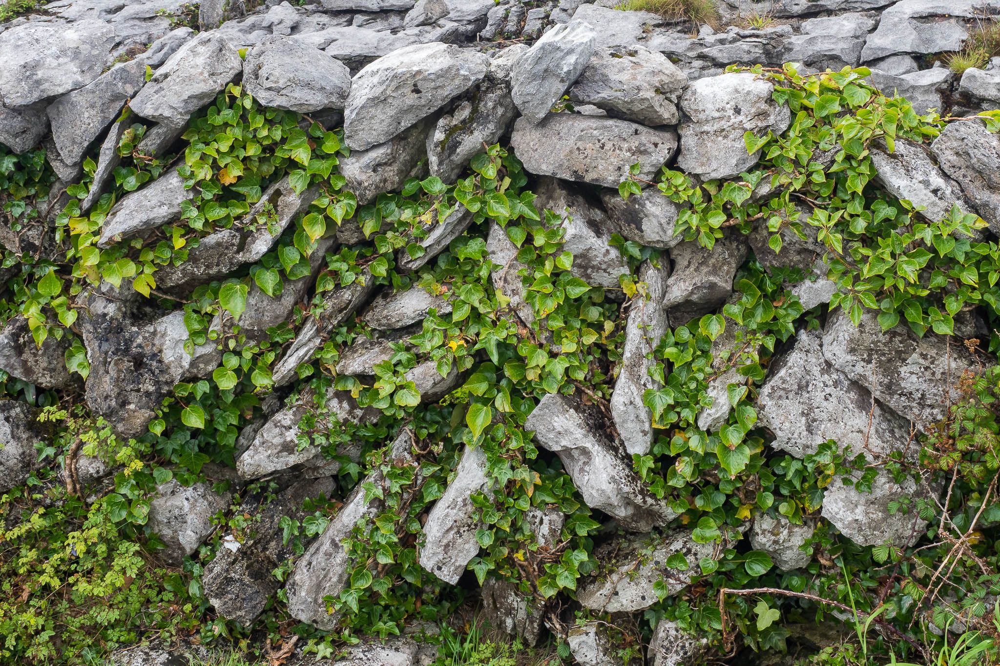
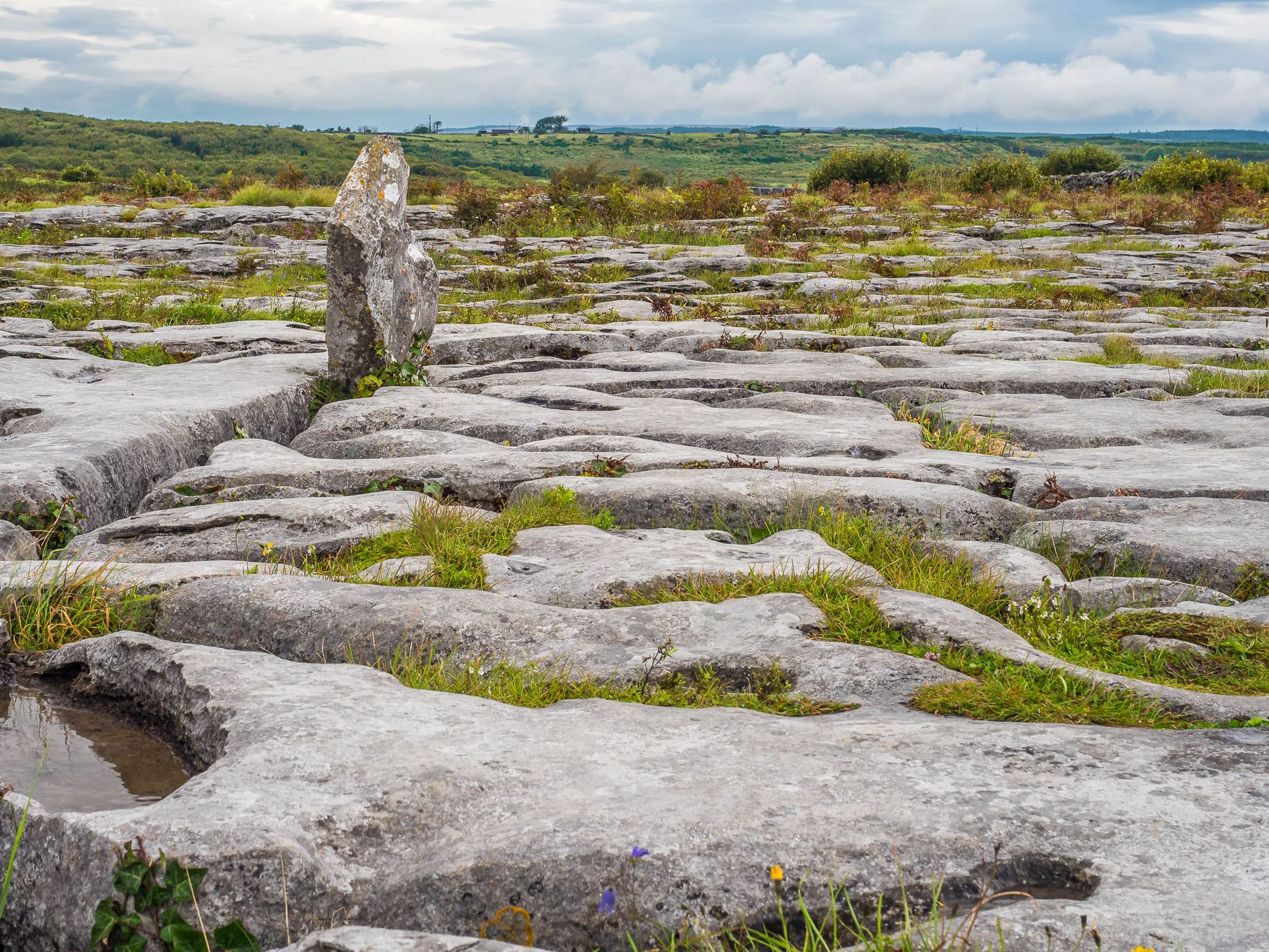
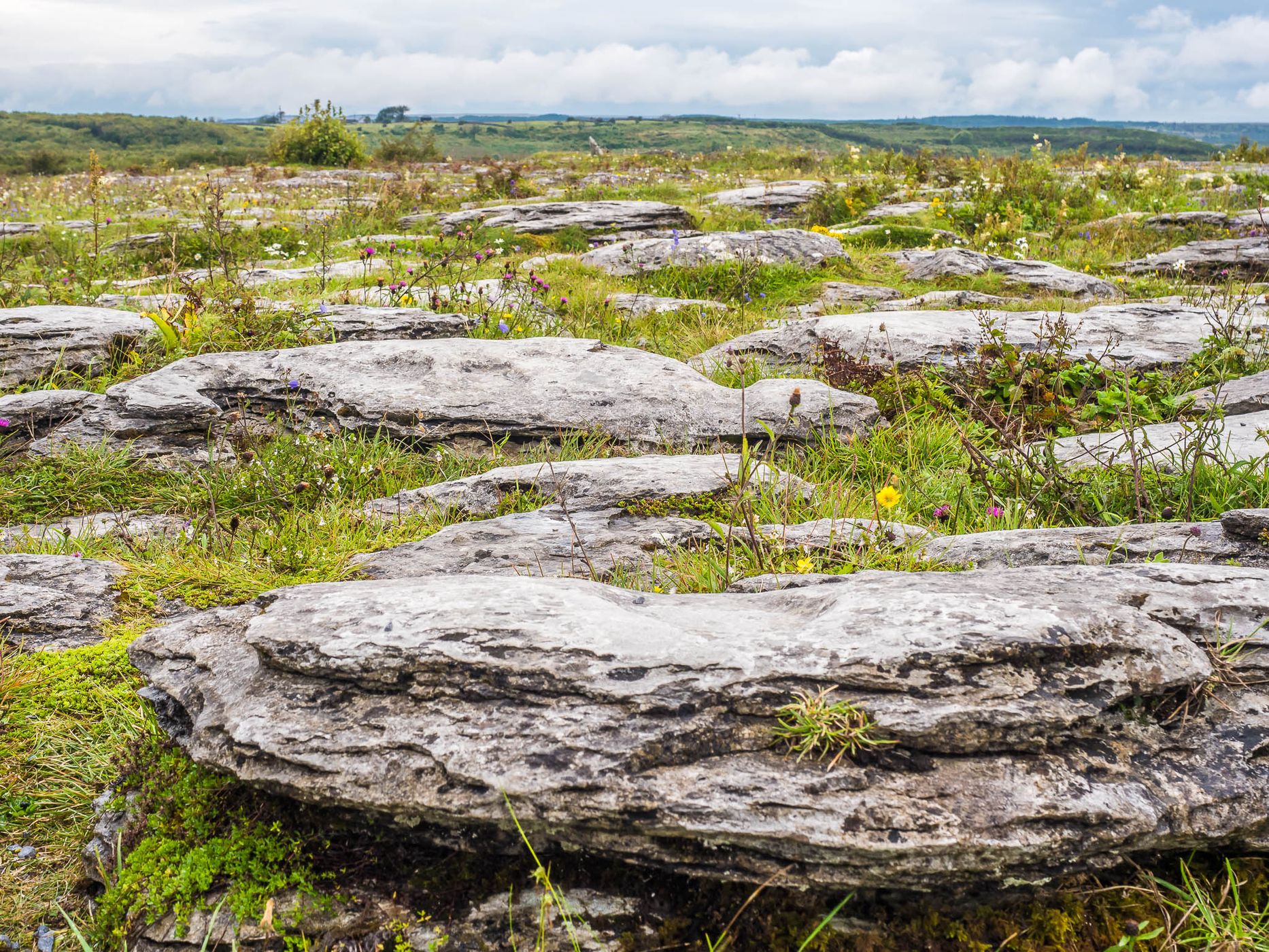
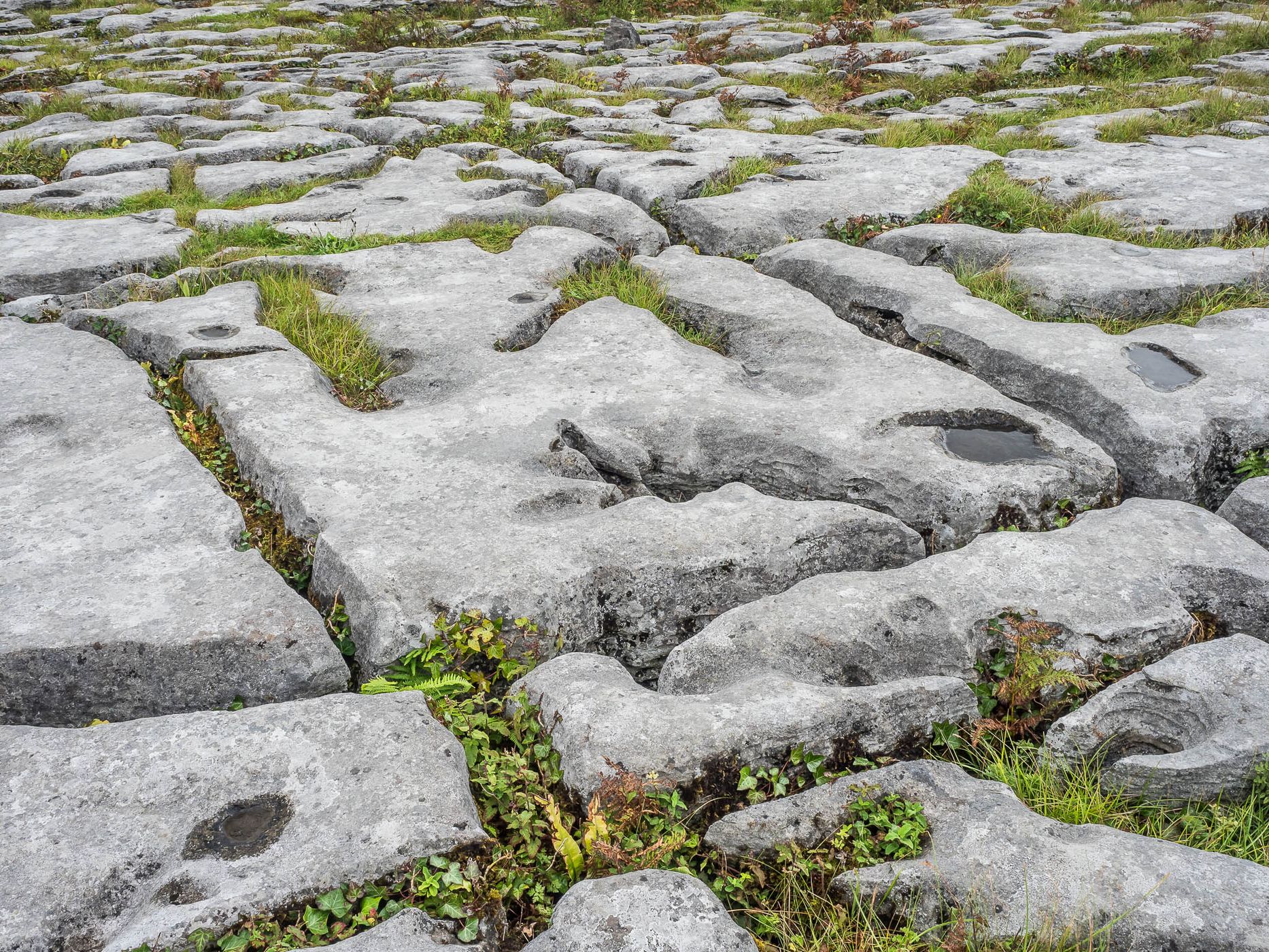
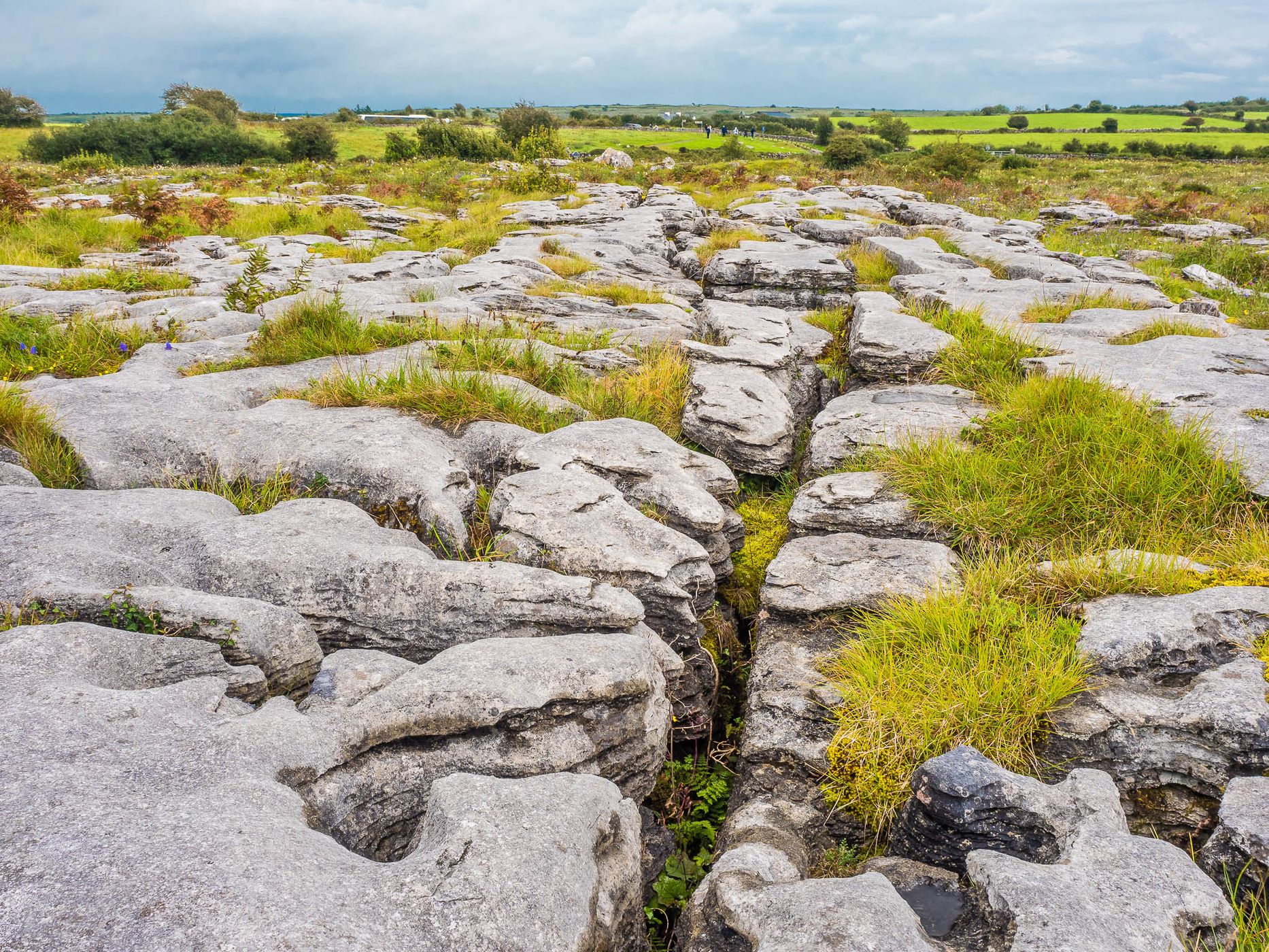
To the north-east of the Cliffs of Moher, a partly bizarre, treeless karst landscape, the "Burren", stretches over 250 km². Together they are a UNESCO Global Geopark. "Stony place" is probably the meaning of Burren. Often these are bare limestone plateaus that allow little vegetation. This makes the diversity of plants in the extreme karst areas all the more astonishing. And plants from alpine and Mediterranean as well as from arctic vegetation zones are represented here.
Spot Type Outdoor
Crowd Factor A decent amount of people
Best Timing Daytime
Sunrise & Sunset 07:16 - 18:20 | current local time: 18:15
Photo Themes Karst
Locations Ballyvaughan

Get the exact geo-position for this spot

Log in to see the GPS coordinates, sun directions, and the map for this photo spot. Or simply bookmark it along with other spots to plan your next trip.

Spot Comments (0)

Please log in or sign up for free to leave a comment or ask a question.

Ratings (1) starstarstarstarstar

starstarstarstarstar
1
starstarstarstarstar
0
starstarstarstarstar
0
starstarstarstarstar
0
starstarstarstarstar
0

Popular photo spots in this region

Thank you Reinhard Prinzmeier for creating this photo spot in Ireland.
Imprint & Contact © Locationscout 2025 Privacy / Terms