
")
Sweden Fämtfallet Waterfall
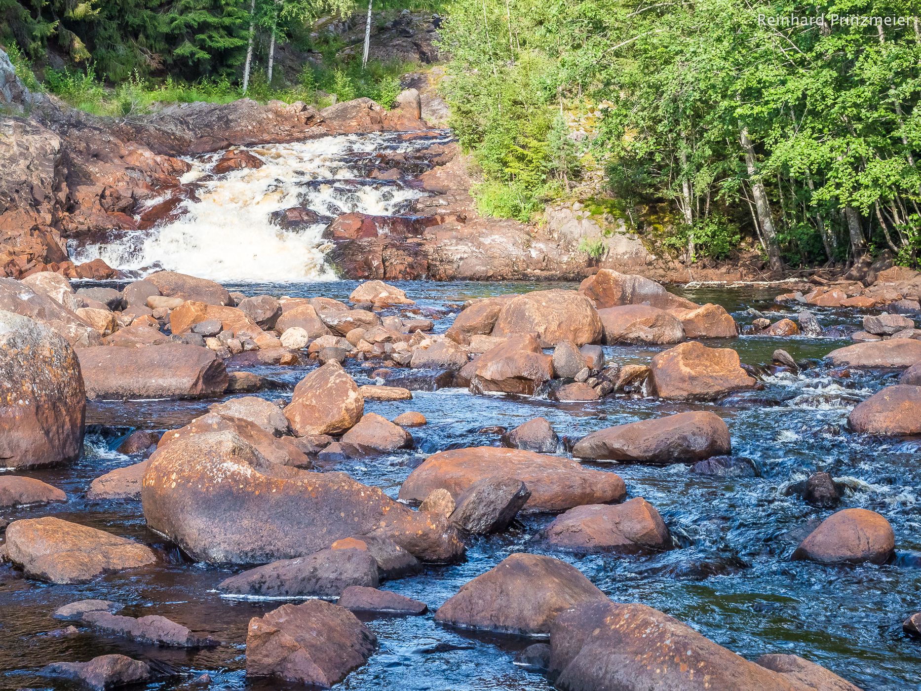
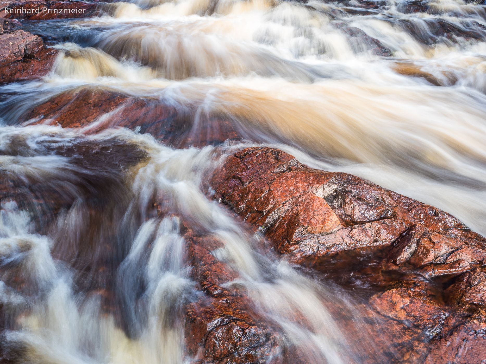
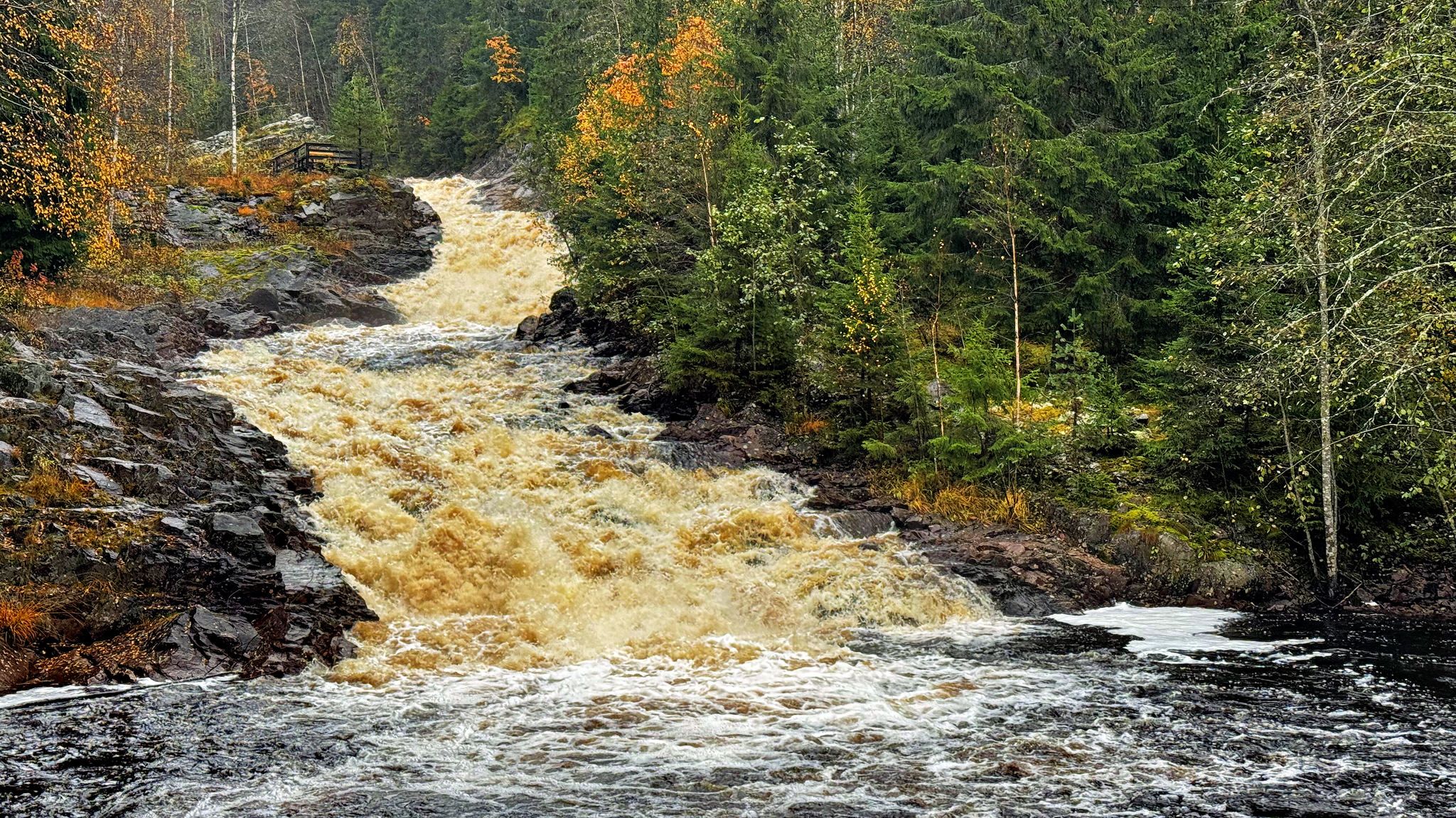
The Fämtfallet is a cascade that extends over several hundred meters. The lower fall flows into a pool, which is used as a bathing place, with pier and stairs into the water.
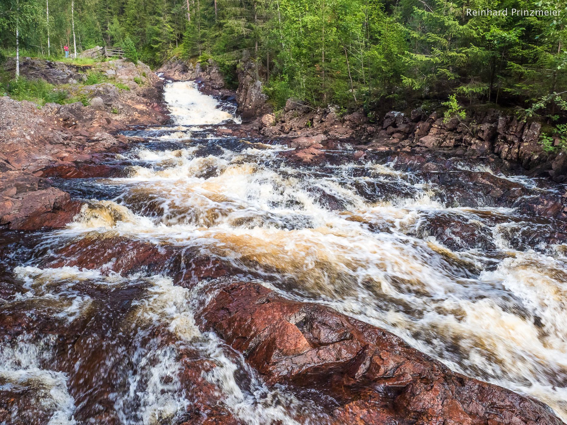
About 3.5 km north of Ambjörby, along national road 62, lies Fämtfallet. The falls have a height of 44 meters, but the total drop height is 100 meters over a distance of 4.2 km. About 1 km upstream, a magnificent canyon has formed and the depth is about 60 meters. Over thousands of years, the water has hollowed out the rock and formed a natural pool, where a bathing jetty has been built.
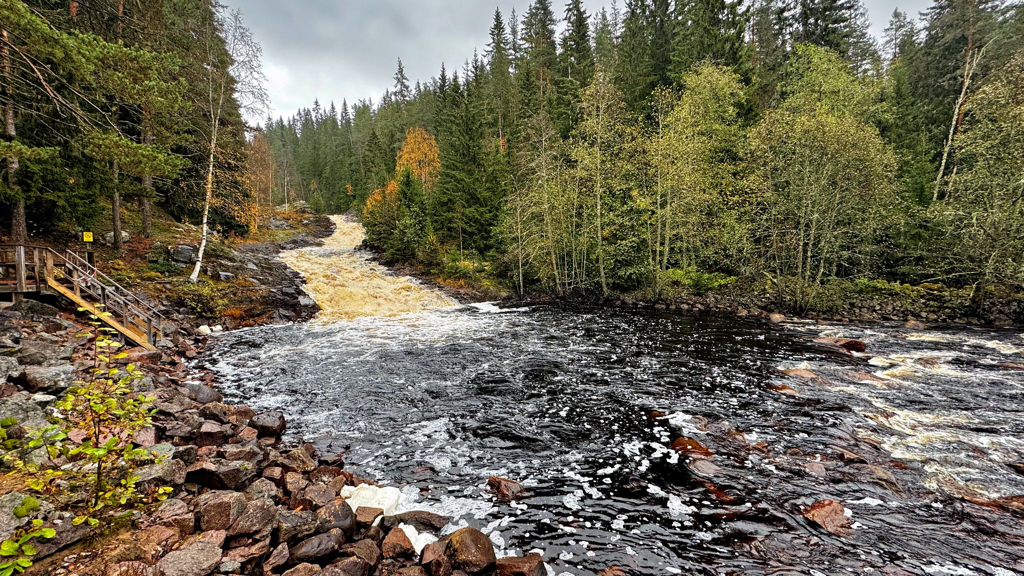
There are hiking trails on both sides of the falls where information about the ancient remains is also provided.
A hiking trail "Fämtleden" begins and ends above the falls, at the upper Fämtbron. The trail is about 7 km long with fantastic nature experiences. The trail crosses Fämtan about 3.5 km upstream where Lake Tällåedan has been formed. An almost 100-year-old suspension bridge takes you over the falls.
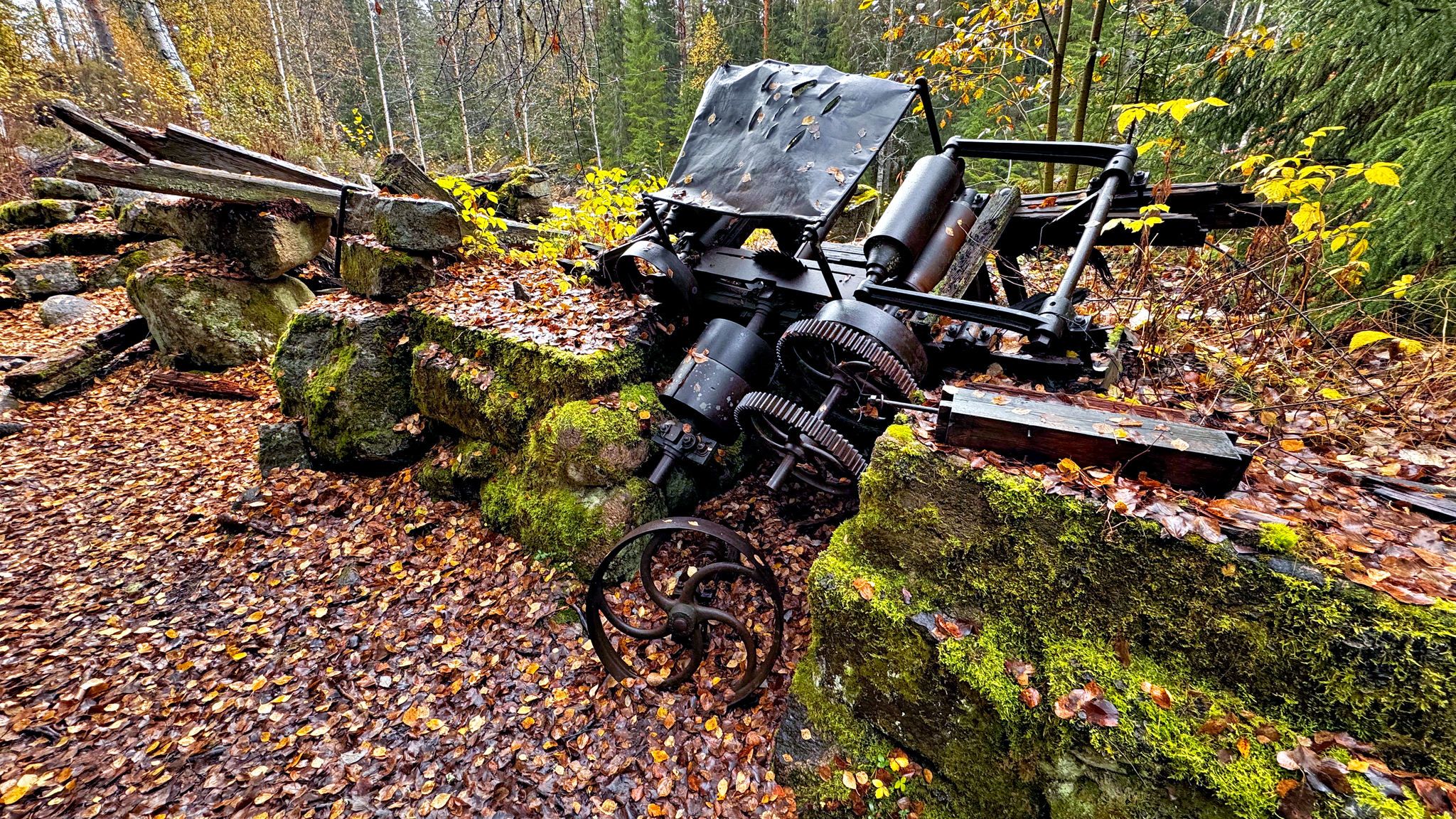
Fämtfallet was long used for hydroelectric power for various activities. There are permanent ancient remains here, including a slag warp that belonged to Femtå Bruk and was operated from 1837 to 1862, as well as remains of a frame saw from the 17th century. Other cultural and historical remains include a customs mill that was owned by the Uddeholmsbolaget and a number of small mills that were owned by farmers in the surrounding villages. The remains of a scalding mill remain. Mills have also existed since the 17th century. You can see the foundations of two power stations, the operation of which was discontinued in the 1940s.
Fämtan was also a rafting route for a couple of hundred years.
About 3.5 km north of Ambjörby, along national road 62, lies Fämtfallet. The falls have a height of 44 meters, but the total drop height is 100 meters over a distance of 4.2 km. About 1 km upstream, a magnificent canyon has formed and the depth is about 60 meters. Over thousands of years, the water has hollowed out the rock and formed a natural pool, where a bathing jetty has been built.
There are hiking trails on both sides of the falls where information about the ancient remains is also provided.
A hiking trail "Fämtleden" begins and ends above the falls, at the upper Fämtbron. The trail is about 7 km long with fantastic nature experiences. The trail crosses Fämtan about 3.5 km upstream where Lake Tällåedan has been formed. An almost 100-year-old suspension bridge takes you over the falls.
Fämtfallet was long used for hydroelectric power for various activities. There are permanent ancient remains here, including a slag warp that belonged to Femtå Bruk and was operated from 1837 to 1862, as well as remains of a frame saw from the 17th century. Other cultural and historical remains include a customs mill that was owned by the Uddeholmsbolaget and a number of small mills that were owned by farmers in the surrounding villages. The remains of a scalding mill remain. Mills have also existed since the 17th century. You can see the foundations of two power stations, the operation of which was discontinued in the 1940s.
Fämtan was also a rafting route for a couple of hundred years.
Photography Tips
Walk along the waterfall as it stretches over several cascades. You have the opportunity to see the remains of the old mill. Take a tripod and paint the water or freeze the action.
Travel Information
There is a large picnic area and campground with a barbecue place and latrine. Free parking along the dirt road is just a few meters away from the waterfall.
Spot Comments (0)